
IMAGES TAKEN NEAR TO
Beech Close, KENDAL, LA9 6AL
Introduction
This page details the photographs taken nearby to Beech Close, LA9 6AL by members of the Geograph project.
The Geograph project started in 2005 with the aim of publishing, organising and preserving representative images for every square kilometre of Great Britain, Ireland and the Isle of Man.

There are currently over 7.5m images from over14,400 individuals and you can help contribute to the project by visiting https://www.geograph.org.uk
Image Map
Images are licensed for reuse under creativecommons.org/licenses/by-sa/2.0
Notes
- Clicking on the map will re-center to the selected point.
- The higher the marker number, the further away the image location is from the centre of the postcode.
Image Listing (12 Images Found)
Images are licensed for reuse under creativecommons.org/licenses/by-sa/2.0
Image
Details
Distance
2

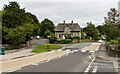
Electricity substation on north side of A684 at Sedbergh Road junction
There is an Ordnance Survey benchmark Image on the front of the building at its left hand corner
Image: © Roger Templeman
Taken: 3 Aug 2024
0.07 miles
3

Benchmark on electricity substation on north side of A684
Ordnance Survey cut mark benchmark levelled at 54.810m above Newlyn Datum verified 1970
Image: © Roger Templeman
Taken: 3 Aug 2024
0.08 miles
4

Junction of Rusland Park from south side of A684 (Sedbergh Road)
Image: © Roger Templeman
Taken: 3 Aug 2024
0.08 miles
5

Houses on the outskirts of Kendal with electricity pylon
Image: © Roy Hughes
Taken: 31 Aug 2024
0.12 miles
6

Benchmark on road end of party wall between #89 and #91 Sedbergh Road
Ordnance Survey cut mark benchmark levelled at 67.312m above Newlyn Datum verified 1970
Image: © Roger Templeman
Taken: 3 Aug 2024
0.12 miles
8

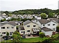
Nos. 21 and 23 Castle Grove
There is an Ordnance Survey benchmark Image on the front of the left hand house, left of its porch just above hedge level
Image: © Roger Templeman
Taken: 10 Aug 2024
0.17 miles
9

Benchmark on #21 Castle Grove
Ordnance Survey cut mark benchmark levelled at 63.480m above Newlyn Datum verified 1970
Image: © Roger Templeman
Taken: 10 Aug 2024
0.17 miles
10
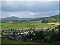
Sandylands Housing Estate, Kendal
Pictured from Kendal Castle, with Whinfell Beacon appearing on the skyline.
Image: © mezmrz
Taken: 26 Jun 2005
0.18 miles