
IMAGES TAKEN NEAR TO
Chapel View, Chapel Lane, KENDAL, LA9 5RE
Introduction
This page details the photographs taken nearby to Chapel View, Chapel Lane, LA9 5RE by members of the Geograph project.
The Geograph project started in 2005 with the aim of publishing, organising and preserving representative images for every square kilometre of Great Britain, Ireland and the Isle of Man.

There are currently over 7.5m images from over14,400 individuals and you can help contribute to the project by visiting https://www.geograph.org.uk
Image Map
Images are licensed for reuse under creativecommons.org/licenses/by-sa/2.0
Notes
- Clicking on the map will re-center to the selected point.
- The higher the marker number, the further away the image location is from the centre of the postcode.
Image Listing (346 Images Found)
Images are licensed for reuse under creativecommons.org/licenses/by-sa/2.0
Image
Details
Distance
1

Blind Beck on west side of Kirkland
There is an Ordnance Survey benchmark Image at the middle of the bridge parapet
Image: © Roger Templeman
Taken: 5 Mar 2022
0.02 miles
2

Gate post outside the Surgery in Gillinggate
When the new surgery was built in Gillinggate, this stone feature of Dean Gibsons School which used to stand on the site was incorporated. Unlike the carving at the boys' entrance (see another picture) the girls' entrance has weathered badly
Image: © Tim Hodgins
Taken: 9 Aug 2013
0.03 miles
3

The Gillinggate Centre on south side of Gillinggate
Health centre incorporating Captain French Surgery and Kentwood Clinic. Converted from former school Image which had a benchmark levelled at 51.377m above Newlyn Datum verified in 1971 on its west angle.
Image: © Roger Templeman
Taken: 23 Jul 2022
0.03 miles
4
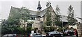
Captain French Surgery on SE side of Gillinggate
Image: © Luke Shaw
Taken: 23 Jul 2022
0.03 miles
5

Queen's Club, Kendal
Grade II listed. Listing number 1145681. House, built parallel to Blind Beck at right-angles to road. Used as Convent in late C19, now Nightclub. Late C18 for Christopher Wilson (initials C & M W on rainwater head).
Image: © Andrew Abbott
Taken: 6 Jul 2017
0.03 miles
6

Blind Beck
This stream, probably called "blind" because its source is hidden in the rock fissures of Kendal Fell, was formerly the boundary between the Borough of Kendal and the Township of Kirkland. Kirkland, on church land since the Norman conquest, had its own court and regulations. Traders whose goods did not meet Kendal's market standards or who could not afford the fees of the Kendal guilds, set up their businesses here. Kirkland thus developed a separate character from Kendal, still recognisable today. (Kendal Civic Society)
Image: © David Rogers
Taken: 14 Aug 2010
0.03 miles
7

Gate post outside the Surgery in Gillinggate
Dean Gibsons School was demolished in 2012/3 and the new surgery built. A number of features from the school were incorporated in the new design, including this carved stone which made it clear where the boys had to enter. The sign for the girls' entrance was also used.
Image: © Tim Hodgins
Taken: 9 Aug 2013
0.03 miles
8

Kendal : Gillinggate
Looking along Gillinggate from Highgate.
Image: © Lewis Clarke
Taken: 23 Sep 2019
0.04 miles
9

Gillinggate seen from Highgate (A6), Kendal
Image: © habiloid
Taken: 28 May 2023
0.04 miles
10

Ordnance Survey Rivet
This OS rivet can be found on the west parapet of Blindback Bridge. It marks a point 46.477m above mean sea level.
Image: © Adrian Dust
Taken: 22 Oct 2023
0.04 miles