
IMAGES TAKEN NEAR TO
Hallgarth Circle, KENDAL, LA9 5NW
Introduction
This page details the photographs taken nearby to Hallgarth Circle, LA9 5NW by members of the Geograph project.
The Geograph project started in 2005 with the aim of publishing, organising and preserving representative images for every square kilometre of Great Britain, Ireland and the Isle of Man.

There are currently over 7.5m images from over14,400 individuals and you can help contribute to the project by visiting https://www.geograph.org.uk
Image Map
Images are licensed for reuse under creativecommons.org/licenses/by-sa/2.0
Notes
- Clicking on the map will re-center to the selected point.
- The higher the marker number, the further away the image location is from the centre of the postcode.
Image Listing (13 Images Found)
Images are licensed for reuse under creativecommons.org/licenses/by-sa/2.0
Image
Details
Distance
3
Kendal : Helsfell Hall
Looking along Helsfell Hall.
Image: © Lewis Clarke
Taken: 23 Sep 2019
0.09 miles
5
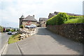
Helsfell Hall
Noticeable architecture on the edge of Kendal. It is a Grade II listed building.
Image: © Bill Boaden
Taken: 7 Jun 2013
0.10 miles
6
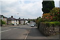
Windermere Road, Kendal
A busy main road with traditional suburban houses.
Image: © Bill Boaden
Taken: 7 Jun 2013
0.10 miles
7
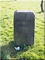
Old Milestone by the B5284, Windermere Road, north west of Kendall
Carved stone post by the B5284, in parish of KENDAL (SOUTH LAKELAND District), Windermere Road, at top of hill out of Kendall, by Airey's Folly, on cut on grass verge between road and pavement, on North side of road. Kendal Lakeside stone, erected by the Ambleside turnpike trust in the 19th century.
Inscription reads:-
: KENDAL / 1 MILE : : WINDERMERE / 7½ MILES :
Carved benchmark and rivet on top front edge.
Milestone Society National ID: WE_KDWM01.
Image: © CF Smith
Taken: 25 Jan 2007
0.12 miles
8
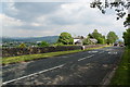
Entering the 30 zone on the edge of Kendal
This part of the A5284 is still higher than the rest of Kendal which is down to the left.
Image: © Bill Boaden
Taken: 7 Jun 2013
0.13 miles
9
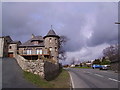
Leaving Kendal
There is some great stonework in Kendal
Image: © Michael Graham
Taken: Unknown
0.13 miles
10
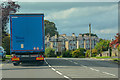
Kendal : Windermere Road A5284
Looking along Windermere Road.
Image: © Lewis Clarke
Taken: 23 Sep 2019
0.22 miles