
IMAGES TAKEN NEAR TO
Brackenwood, KENDAL, LA9 5DQ
Introduction
This page details the photographs taken nearby to Brackenwood, LA9 5DQ by members of the Geograph project.
The Geograph project started in 2005 with the aim of publishing, organising and preserving representative images for every square kilometre of Great Britain, Ireland and the Isle of Man.

There are currently over 7.5m images from over14,400 individuals and you can help contribute to the project by visiting https://www.geograph.org.uk
Image Map
Images are licensed for reuse under creativecommons.org/licenses/by-sa/2.0
Notes
- Clicking on the map will re-center to the selected point.
- The higher the marker number, the further away the image location is from the centre of the postcode.
Image Listing (11 Images Found)
Images are licensed for reuse under creativecommons.org/licenses/by-sa/2.0
Image
Details
Distance
1
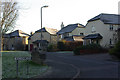
Brackenwood, Kendal
A modern housing development off Brigsteer Road.
Image: © Stephen McKay
Taken: 27 Dec 2008
0.02 miles
2
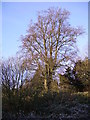
Beech Brigsteer Road
Brigsteer Road climbs out of Kendal towards Helsington Barrows
Image: © Michael Graham
Taken: Unknown
0.08 miles
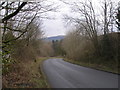
4
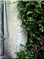
Benchmark on gatepost of #41 Greengate Lane
Ordnance Survey cut mark benchmark levelled at 72.314m above Newlyn Datum verified 1972
Image: © Roger Templeman
Taken: 28 Jul 2010
0.18 miles
5
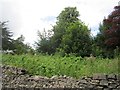
"Jungle" off Brigsteer Road
A bit of overgrown land on the edge of Kendal.
Image: © Richard Webb
Taken: 6 Aug 2012
0.20 miles
6
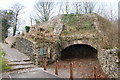
Greenside Lime Kiln
The remains of earlier quarrying activity, whilst there was recently an active quarry slightly further up the hill. Quarrying stopped in 1992 but the site is there now used for landfill. The lime kiln was marked on an Ordnance Survey map of 1858.
Image: © Bill Boaden
Taken: 28 Feb 2014
0.21 miles
7
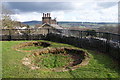
The top of Greenside Lime Kiln
Remains of former quarrying on the western edge of Kendal. You cannot quite see down onto the town from this site.
Image: © Bill Boaden
Taken: 28 Feb 2014
0.21 miles
8
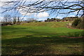
The edge of Kendal Golf Club
The course is quite a hilly one. This is the bottom end near Kendal Fell Quarry.
Image: © Bill Boaden
Taken: 28 Feb 2014
0.22 miles
9

Spirelet on dormer gable, Captain French Lane, Kendal
Perhaps Harry Potter's great-great-grandmother lived here? There is a similar spirelet on Hill Cote, Gilling Gate, which is an 'Arts and Crafts' house built in the 1890s.
Image: © Humphrey Bolton
Taken: 7 May 2006
0.23 miles
10

Brigsteer Road
Looking towards Kendal.
Image: © Richard Webb
Taken: 6 Aug 2012
0.23 miles