
IMAGES TAKEN NEAR TO
Earle Court, KENDAL, LA9 4SF
Introduction
This page details the photographs taken nearby to Earle Court, LA9 4SF by members of the Geograph project.
The Geograph project started in 2005 with the aim of publishing, organising and preserving representative images for every square kilometre of Great Britain, Ireland and the Isle of Man.

There are currently over 7.5m images from over14,400 individuals and you can help contribute to the project by visiting https://www.geograph.org.uk
Image Map
Images are licensed for reuse under creativecommons.org/licenses/by-sa/2.0
Notes
- Clicking on the map will re-center to the selected point.
- The higher the marker number, the further away the image location is from the centre of the postcode.
Image Listing (75 Images Found)
Images are licensed for reuse under creativecommons.org/licenses/by-sa/2.0
Image
Details
Distance
1
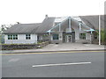
Former County and Magistrates Court, Kendal
Situated in Burneside Road LA9 4NF, this courthouse was closed on Friday 30th June 2017, with business transferred to Barrow-in-Furness. It remains to be seen what will happen to these premises now that they are no longer in use.
Image: © David Hillas
Taken: 23 Jul 2017
0.03 miles
2
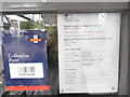
Closure Notice at County and Magistrates Court, Kendal
This photo shows the closure notice at the entrance to the County and Magistrates Court in Burneside Road, Kendal LA9 4NF, the closure taking effect from Friday 30th June 2017. A Royal Mail collection point notice is on the left of the photo.
Image: © David Hillas
Taken: 23 Jul 2017
0.03 miles
3
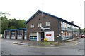
Kendal fire station
Kendal fire station, Busher Walk, Kendal, Cumbria
Image: © Kevin Hale
Taken: 29 May 2010
0.10 miles
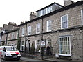
5

Ordnance Survey Cut Mark
This OS cut mark can be found on No20 Burneside Road. It marks a point 52.425m above mean sea level.
Image: © Adrian Dust
Taken: 26 Oct 2023
0.12 miles
6

Ordnance Survey Cut Mark
This OS cut mark can be found on No26 Union Street. It marks a point 53.870m above mean sea level.
Image: © Adrian Dust
Taken: 26 Oct 2023
0.12 miles

8

Looking from Stricklandgate into Burneside Road
Image: © Basher Eyre
Taken: 16 Feb 2015
0.13 miles
9
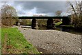
Railway Bridge over the River Kent
This structure carries the Windermere Branch Line over the River Kent in Kendal.
Image: © Chris Heaton
Taken: 8 Apr 2016
0.13 miles
10
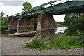
Railway bridge over River Kent
Carries the Windermere branch line. The piers and abutments indicate that this bridge has been reduced from double to single track. The deck beams have been replaced or rebuilt.
Image: © Ian Taylor
Taken: 28 Jun 2017
0.13 miles