
IMAGES TAKEN NEAR TO
Airlie Villas, Gillinggate, KENDAL, LA9 4JD
Introduction
This page details the photographs taken nearby to Airlie Villas, Gillinggate, LA9 4JD by members of the Geograph project.
The Geograph project started in 2005 with the aim of publishing, organising and preserving representative images for every square kilometre of Great Britain, Ireland and the Isle of Man.

There are currently over 7.5m images from over14,400 individuals and you can help contribute to the project by visiting https://www.geograph.org.uk
Image Map
Images are licensed for reuse under creativecommons.org/licenses/by-sa/2.0
Notes
- Clicking on the map will re-center to the selected point.
- The higher the marker number, the further away the image location is from the centre of the postcode.
Image Listing (301 Images Found)
Images are licensed for reuse under creativecommons.org/licenses/by-sa/2.0
Image
Details
Distance
1

Benchmark on the side of #15 Gillinggate
An Ordnance Survey cut mark benchmark which is described on the Bench Mark Database at http://www.bench-marks.org.uk/bm27959
Image: © Roger Templeman
Taken: 28 Jul 2010
0.01 miles
2

Ordnance Survey Cut Mark
This OS cut mark can be found on No15 Gillinggate. It marks a point 55.640m above mean sea level.
Image: © Adrian Dust
Taken: 22 Oct 2023
0.01 miles
3

Houses on Gillinggate, Kendal
The junction on Gillinggate is with Anchorite Fields.
Image: © Nick Smith
Taken: Unknown
0.01 miles
4

Houses on south side of Gillinggate at Anchorite Fields junction
There is an Ordnance Survey benchmark Image on the corner, right hand face, of the nearest house (#15)
Image: © Roger Templeman
Taken: 23 Jul 2022
0.02 miles
5

#47 Captain French Lane (Rock House) at Garth Heads junction
There is an Ordnance Survey benchmark Image on the near ground floor windowsill
Image: © Roger Templeman
Taken: 23 Jul 2022
0.06 miles

7
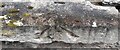
Benchmark on windowsill of #47 Captain French Lane
Ordnance Survey rivet benchmark levelled at 55.650m above Newlyn Datum verified 1971
Image: © Roger Templeman
Taken: 23 Jul 2022
0.06 miles
8

Gate post outside the Surgery in Gillinggate
Dean Gibsons School was demolished in 2012/3 and the new surgery built. A number of features from the school were incorporated in the new design, including this carved stone which made it clear where the boys had to enter. The sign for the girls' entrance was also used.
Image: © Tim Hodgins
Taken: 9 Aug 2013
0.07 miles
9

Benchmark on St Abbs, Gillinggate
Ordnance Survey cut mark benchmark levelled at 65.770m above Newlyn Datum verified 19712
Image: © Roger Templeman
Taken: 28 Jul 2010
0.07 miles
10

Ordnance Survey Cut Mark
This OS cut mark can be found on St Abbs House, Gillinggate. It marks a point 65.770m above mean sea level.
Image: © Adrian Dust
Taken: 22 Oct 2023
0.07 miles