
IMAGES TAKEN NEAR TO
Blackhall Road, KENDAL, LA9 4BW
Introduction
This page details the photographs taken nearby to Blackhall Road, LA9 4BW by members of the Geograph project.
The Geograph project started in 2005 with the aim of publishing, organising and preserving representative images for every square kilometre of Great Britain, Ireland and the Isle of Man.

There are currently over 7.5m images from over14,400 individuals and you can help contribute to the project by visiting https://www.geograph.org.uk
Image Map
Images are licensed for reuse under creativecommons.org/licenses/by-sa/2.0
Notes
- Clicking on the map will re-center to the selected point.
- The higher the marker number, the further away the image location is from the centre of the postcode.
Image Listing (410 Images Found)
Images are licensed for reuse under creativecommons.org/licenses/by-sa/2.0
Image
Details
Distance
1
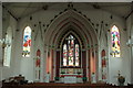
Holy Trinity and Saint George Catholic Church Kendal
Church interior showing stained glass windows.
Image: © edward mcmaihin
Taken: 29 Jul 2013
0.01 miles
2
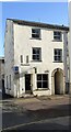
No. 37 Stramongate at Blackhall Road junction
There is an Ordnance Survey benchmark Image on the left hand side of the arch entrance, on the 6th stone above the pavement
Image: © Roger Templeman
Taken: 5 Mar 2022
0.01 miles
3
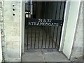
Benchmark on Stramongate arch
Ordnance Survey cut mark benchmark on arch entrance to 31&37 Stramongate. For more information on the mark see the Bench Mark Database at http://www.bench-marks.org.uk/bm27764.
Image: © Roger Templeman
Taken: 28 Jul 2010
0.02 miles
4
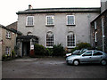
Friends' Meeting House, Stramongate
There has been a Quaker Meeting House on this site since 1688. This building was constructed in 1816 and houses a Tapestry Museum. See also Image
My ancestors, Sarah Airey and Joseph Burgess, were married in the original building in 1769.
Image: © John Lucas
Taken: 5 Nov 2003
0.02 miles

6
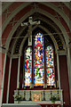
Holy Trinity and Saint George Catholic Church Kendal
Church interior showing stained glass window.
Image: © edward mcmaihin
Taken: 29 Jul 2013
0.02 miles
7
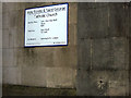
OS benchmark on Holy Trinity and St George RC Church, Kendal
At an altitude of 44.300m asl.
Image: © Karl and Ali
Taken: 25 Oct 2015
0.02 miles
8
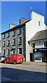
#53 Stramongate
There is an Ordnance Survey benchmark Image on the near corner, road face, of the building, next to the wheelie bin
Image: © Roger Templeman
Taken: 19 Mar 2022
0.02 miles
9
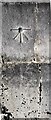
Benchmark on Holy Trinity/St George's RC Church
Ordnance Survey 1GL bolt benchmark levelled at 44.300m above Newlyn Datum verified 1953. The mark was levelled at 145.180 feet above Liverpool Datum during the Liverpool to Port Carlisle 1GL Survey of 1841-1844. The surveyor's description was 'No. 284. Bolt in North-east corner of Kendal Roman Catholic Chapel ; 3.82 ft. above surface'
Image: © Roger Templeman
Taken: 5 Mar 2022
0.03 miles
10
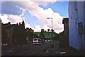
Blackhall Road in May 2000
The southern section of Blackhall Road, seen from the Stramongate crossroads. Part of Kendal Castle may be seen between the trees on the horizon.
Image: © Ruth Riddle
Taken: 30 May 2000
0.03 miles