
IMAGES TAKEN NEAR TO
New Road, KENDAL, LA9 4AY
Introduction
This page details the photographs taken nearby to New Road, LA9 4AY by members of the Geograph project.
The Geograph project started in 2005 with the aim of publishing, organising and preserving representative images for every square kilometre of Great Britain, Ireland and the Isle of Man.

There are currently over 7.5m images from over14,400 individuals and you can help contribute to the project by visiting https://www.geograph.org.uk
Image Map
Images are licensed for reuse under creativecommons.org/licenses/by-sa/2.0
Notes
- Clicking on the map will re-center to the selected point.
- The higher the marker number, the further away the image location is from the centre of the postcode.
Image Listing (426 Images Found)
Images are licensed for reuse under creativecommons.org/licenses/by-sa/2.0
Image
Details
Distance
1
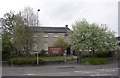
Friends' Meeting House, New Road, Kendal
A simple, ashlar-faced house designed by Francis Webster and built of limestone blocks in 1816, partly on the site of a 17C meeting house. It has its original internal fittings, although altered internally in 1934 and extended eastward in 1936. It houses a Quaker tapestry exhibition, which has 77 tapestry panels made by 4000 people from 15 countries.
Image: © Humphrey Bolton
Taken: 7 May 2006
0.02 miles
2
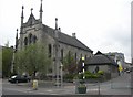
Roman Catholic Church, New Road, Kendal
This church is dedicated to the Holy Trinity and St George, and is one of many buildings in Kendal designed by George Webster. It was built between 1835 and 1837 in a neo-Gothic style, and replaced a house in Stramongate that had been used as a Catholic chapel. The statue of St George slaying the dragon over the doorway was by Thomas Duckett, and there are two more of his works inside the church - Ecce homo on the left and St George on the right as you enter.
Image: © Humphrey Bolton
Taken: 7 May 2006
0.02 miles
3
Kendal : Pavement
A pavement alongside the River Kent.
Image: © Lewis Clarke
Taken: 25 Sep 2019
0.02 miles
4
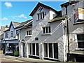
No 7 Stramongate
Dating from the 16th century, this was originally the town house of local landowners the Bellingham family. For more information see Images of England http://www.imagesofengland.org.uk/Details/Default.aspx?id=75487 .
In recent times the building was occupied for about 25 years by Henry Roberts' Bookshop, which closed in 2014.
There is a dated plaque above the dormer window - see Image .
Image: © Rose and Trev Clough
Taken: 19 Apr 2016
0.03 miles
5
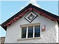
Decorated eaves and coat of arms, 7 Stramongate
At the top of the building shown here Image .
Originally a house belonging to the Bellingham family, probably built in the 16th century. The diamond-shaped plaque showing the Bellingham coat of arms was installed by a later owner, who restored the building in 1863. Around the shield is an inscription (which we can't decipher) with the date 1546. The carved barge boards are also a 19th century addition (information from Historic England listing description http://www.imagesofengland.org.uk/Details/Default.aspx?id=75487 ).
The Bellinghams were wealthy landowners in the former county of Westmorland - see also Image .
Image: © Rose and Trev Clough
Taken: 19 Apr 2016
0.03 miles

7
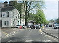
Kent Street approaching Bridge Street, Kendal
Image: © John Firth
Taken: 9 May 2012
0.03 miles
8

Benchmark on parapet of Miller Bridge, New Road
Ordnance Survey cut mark benchmark levelled at 147.237 feet above Liverpool Datum during the 1GL Surveys of 1841 to 1844. It was Mark 1 on the Kirkby Kendal to Carlisle Line, and Mark 283 on the Liverpool to Port Carlisle line. The surveyor's description was 'Mark on West parapet of North-east side of Miller's Bridge, Kent-street ; 2.46 ft.above surface of road'.
Image: © Roger Templeman
Taken: 23 Jul 2022
0.03 miles
9
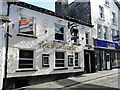
The Dun Horse, Stramongate
For history of this pub, see Visit Cumbria https://www.visitcumbria.com/sl/kendal-dunhorse/.
It is a Grade II listed building - https://historicengland.org.uk/listing/the-list/list-entry/1311814.
There is a plaque on the wall - see Image
Image: © Rose and Trev Clough
Taken: 19 Apr 2016
0.03 miles
10
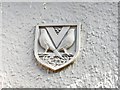
Shield on wall of Dun Horse pub
For situation, see Image .
Two birds either side of a letter 'V', with some cherries and foliage.
Image: © Rose and Trev Clough
Taken: 19 Apr 2016
0.03 miles