
IMAGES TAKEN NEAR TO
Sizergh, KENDAL, LA8 8DY
Introduction
This page details the photographs taken nearby to LA8 8DY by members of the Geograph project.
The Geograph project started in 2005 with the aim of publishing, organising and preserving representative images for every square kilometre of Great Britain, Ireland and the Isle of Man.

There are currently over 7.5m images from over14,400 individuals and you can help contribute to the project by visiting https://www.geograph.org.uk
Image Map
Images are licensed for reuse under creativecommons.org/licenses/by-sa/2.0
Notes
- Clicking on the map will re-center to the selected point.
- The higher the marker number, the further away the image location is from the centre of the postcode.
Image Listing (19 Images Found)
Images are licensed for reuse under creativecommons.org/licenses/by-sa/2.0
Image
Details
Distance
1
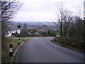
Leaving Heaves
In between Sizergh and Levens. In the Autumn I suppose it could be Heaving Leaves.
Image: © Michael Graham
Taken: Unknown
0.09 miles

4

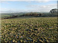
Path near Sizergh
Heading towards Duke Plantation which is seen ahead.
Image: © Bill Boaden
Taken: 24 Jun 2019
0.15 miles
6

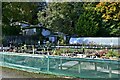
Cars parked by Nannypie Lane, south of Sizergh
A convenient parking place near the A590, useful for car-sharing, and also access to footpaths
Image: © David Smith
Taken: 4 Oct 2016
0.16 miles
7

Levens : A590
The A590 heading through the Levens parish.
Image: © Lewis Clarke
Taken: 23 Sep 2019
0.21 miles

9

Path near Sizergh
The path across this field is not very visible. That is not surprising as it probably doesn't get much use, leading to the junction of the A590 and A591.
Image: © Bill Boaden
Taken: 24 Jun 2019
0.21 miles
10

Walking to Sizergh Castle
A grassy path leads down from Sizergh Fell giving good views of the National Trust property with its car park busy on a warm Bank Holiday Sunday. On the skyline is the Whinfell ridge beyond Kendal.
Image: © Karl and Ali
Taken: 1 May 2011
0.22 miles