
IMAGES TAKEN NEAR TO
Lambrigg, KENDAL, LA8 0DG
Introduction
This page details the photographs taken nearby to LA8 0DG by members of the Geograph project.
The Geograph project started in 2005 with the aim of publishing, organising and preserving representative images for every square kilometre of Great Britain, Ireland and the Isle of Man.

There are currently over 7.5m images from over14,400 individuals and you can help contribute to the project by visiting https://www.geograph.org.uk
Image Map
Images are licensed for reuse under creativecommons.org/licenses/by-sa/2.0
Notes
- Clicking on the map will re-center to the selected point.
- The higher the marker number, the further away the image location is from the centre of the postcode.
Image Listing (13 Images Found)
Images are licensed for reuse under creativecommons.org/licenses/by-sa/2.0
Image
Details
Distance

2

Field gateway at Tod Thorn on north side of road north of Kiln Head
The gateway appears to have been widened and gateposts removed since a benchmark levelled at 194.225m above Newlyn Datum was verified in 1970 on a gatepost at this gateway
Image: © Roger Templeman
Taken: 13 Jul 2022
0.05 miles
3

Frozen Stream below Lambrigg Fell
This stream was frozen after a sharp overnight frost and temperatures hovering around zero all day. The stream drains Lambrigg Fell and is a tributary of the River Mint.
Image: © Stephen McKay
Taken: 23 Dec 2007
0.16 miles
4

Kiln Head
Derelict building near Kiln Head.
Image: © Peter McDermott
Taken: 23 Jul 2016
0.16 miles
5

Field gateway on northwest side of rural road southwest of Kiln Head
Image: © Luke Shaw
Taken: 8 Sep 2023
0.16 miles

7

Widened gateway on north side of road east of Kiln Head
Ordnance Survey documents indicate that a benchmark levelled at 200.340m above Newlyn Datum was verified in 1970 on a gatepost previously at this gateway
Image: © Roger Templeman
Taken: 13 Jul 2022
0.18 miles

9

Benchmark on rock on SE side of road SW of Kiln Head
Ordnance Survey rivet benchmark levelled at 182.999m above Newlyn Datum verified 1970
Image: © Roger Templeman
Taken: 8 Sep 2023
0.19 miles
10
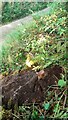
Large rock on SE side of rural road between Kiln Head and Hollins
There is an Ordnance Survey benchmark Image on the rock: a rivet on the top of the rock with arrowhead cuts on its back
Image: © Roger Templeman
Taken: 8 Sep 2023
0.19 miles