
IMAGES TAKEN NEAR TO
New Hutton, KENDAL, LA8 0AL
Introduction
This page details the photographs taken nearby to LA8 0AL by members of the Geograph project.
The Geograph project started in 2005 with the aim of publishing, organising and preserving representative images for every square kilometre of Great Britain, Ireland and the Isle of Man.

There are currently over 7.5m images from over14,400 individuals and you can help contribute to the project by visiting https://www.geograph.org.uk
Image Map
Images are licensed for reuse under creativecommons.org/licenses/by-sa/2.0
Notes
- Clicking on the map will re-center to the selected point.
- The higher the marker number, the further away the image location is from the centre of the postcode.
Image Listing (6 Images Found)
Images are licensed for reuse under creativecommons.org/licenses/by-sa/2.0
Image
Details
Distance
1
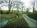
Footbridge near Strawberry bank
Carries the Public Footpath which links Strawberry Bank and Ashes Farm
Image: © Michael Graham
Taken: Unknown
0.01 miles
2
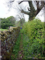
The bridleway at Strawberry Bank
A narrow, bluebell-fringed track from Ashes Farm - not much space for horses to pass though.
Image: © Karl and Ali
Taken: 29 Apr 2011
0.07 miles
3
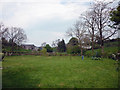
Hawkrigg
Seen from the bridleway near Strawberry Bank.
Image: © Karl and Ali
Taken: 29 Apr 2011
0.12 miles
4
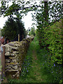
Bridleway, Ashes Farm
Looking towards the church at New Hutton. Not a place to meet a large, oncoming shire horse.
Image: © Karl and Ali
Taken: 29 Apr 2011
0.18 miles
5
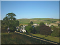
The path to New Hutton
The footpath approaching New Hutton from Hawkrigg climbs over the brow of a small hill before descending into the pleasant little village.
Image: © Karl and Ali
Taken: 23 Jul 2014
0.22 miles
6
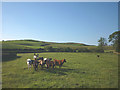
Young cattle at Hawkrigg End
Like many young cattle, these were very curious and started approaching for a closer look - they are looking towards Ali who is heading for the nearby stile! A typically rural scene in this pleasant, quiet area east of Kendal.
Image: © Karl and Ali
Taken: 23 Jul 2014
0.24 miles