
IMAGES TAKEN NEAR TO
Crooklands, MILNTHORPE, LA7 7NS
Introduction
This page details the photographs taken nearby to LA7 7NS by members of the Geograph project.
The Geograph project started in 2005 with the aim of publishing, organising and preserving representative images for every square kilometre of Great Britain, Ireland and the Isle of Man.

There are currently over 7.5m images from over14,400 individuals and you can help contribute to the project by visiting https://www.geograph.org.uk
Image Map
Images are licensed for reuse under creativecommons.org/licenses/by-sa/2.0
Notes
- Clicking on the map will re-center to the selected point.
- The higher the marker number, the further away the image location is from the centre of the postcode.
Image Listing (39 Images Found)
Images are licensed for reuse under creativecommons.org/licenses/by-sa/2.0
Image
Details
Distance
1

Slip road joining the M6, at junction 36 northbound
Image: © Ann Cook
Taken: 10 Sep 2011
0.10 miles
2

Bridge 164, Lancaster Canal
At Millness
Image: © Michael Graham
Taken: 4 Feb 2010
0.14 miles
3

Millness Slipway
By the M6 Culvert. The canal is navigable for another two miles north to Stainton from here.
Image: © Michael Graham
Taken: 4 Feb 2010
0.14 miles
4

Millness Culvert, Lancaster Canal
On the north side of the M6
Image: © Michael Graham
Taken: 4 Feb 2010
0.15 miles
5

M6 Southbound, Bridge at Junction 36
The bridge carrying the A590/A65 over the southbound M6 at junction 36.
Image: © David Dixon
Taken: 27 Oct 2011
0.16 miles
6

OS Bench Mark
Ordnance Survey cut bench mark from the 1st, nineteenth-century, levelling, on west abutment of Millness Bridge, north side, over Lancaster-Kendal canal - see Image 151.1 feet above old datum.
Image: © Phil Johnstone
Taken: 23 Jun 2024
0.16 miles
7

Canal Feeder, Lancaster Canal at Crooklands
The feeder is a channel which conveys water from Peasey Beck which at this point is actually flowing underneath the canal. St Patrick's Church can be seen up on its hill.
Image: © Karl and Ali
Taken: 2 May 2011
0.16 miles
8

Lancaster Canal at Millness
The canal is no longer navigable at this juncture, since the construction of the M6 motorway.
It is, however, a fine place to walk and admire the diverse array of vegetation.
Image: © Chris Heaton
Taken: 17 Aug 2022
0.16 miles
9
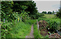
Lancaster Canal blocked off at Millness
Sections of the northern reaches of Lancaster Canal have been isolated by the M6.
Here at Millness the canal comes up against an embankment upon which the motorway was constructed. No bridge was built to allow the canal to carry traffic underneath - only a culvert to permit the free flow of water. This occurs at 3 or 4 places along its length.
This now appears to have been a short sighted option, as the popularity of canals has since much increased.
Image: © Chris Heaton
Taken: 6 Jul 2015
0.16 miles
10
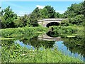
Millness Bridge
The northern reaches of the Lancaster Canal were severed from the main body of the canal by the construction in 1965 of culverts under the M6 at two points, and under the A65 dual carriageway. This is the southern end of a clear 6 km section which runs north to Stainton which forms an attractive wildlife haven.
Image: © Oliver Dixon
Taken: 2 Jun 2024
0.16 miles