IMAGES TAKEN NEAR TO
Middleton, CARNFORTH, LA6 2NQ
Introduction
This page details the photographs taken nearby to LA6 2NQ by members of the Geograph project.
The Geograph project started in 2005 with the aim of publishing, organising and preserving representative images for every square kilometre of Great Britain, Ireland and the Isle of Man.

There are currently over 7.5m images from over14,400 individuals and you can help contribute to the project by visiting https://www.geograph.org.uk
Image Map
Images are licensed for reuse under creativecommons.org/licenses/by-sa/2.0
Notes
- Clicking on the map will re-center to the selected point.
- The higher the marker number, the further away the image location is from the centre of the postcode.
Image Listing (10 Images Found)
Images are licensed for reuse under creativecommons.org/licenses/by-sa/2.0
Image
Details
Distance
1
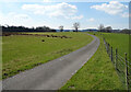
Ford over the beck at Treasonfield
The public bridleway appears to end at Treasonfield just ahead but the metalled track beyond seems to be accessible to the public (there is a bridleway sign at the junction with the road).
Image: © Karl and Ali
Taken: 21 Apr 2012
0.06 miles
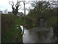
2
Treasonfield Ford
This ford is found on High Beckfoot Lane, a track leading down from Treasonfield Farm.
Image: © John Walton
Taken: 21 Sep 2023
0.06 miles
3
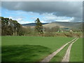
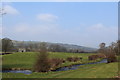
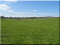
Treasonfield Farm
Looking east over the River Lune, hidden from sight. The track leads to a ford across the river for farm vehicles. This is not shown on the 1:25,000 map.
Image: © David Medcalf
Taken: 1 May 2006
0.10 miles
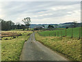
5
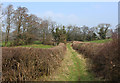
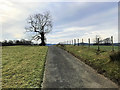
High Beckfoot Lane (3)
Bridleway approaching Treasonfield.
The map appears to show that the right of way ends abruptly at the farm, the way through maybe private - I did not proceed to investigate.
Image: © Chris Heaton
Taken: 18 Mar 2015
0.14 miles
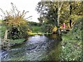
6
Eller Beck
Watercourse seen near Treasonfield, flowing towards the River Lune
Image: © Chris Heaton
Taken: 18 Mar 2015
0.17 miles
10
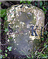
Milestone with bench mark on the A683 just north of Barbon
Battered and neglected but still just about visible if on foot. It seems to be saying S (Sedbergh) 7 miles and KL (Kirkby Lonsdale) 3 miles. There is a bench mark on the top which doesn't seem to be on the OS database.
Update: the figures should read 'Kirkby Lonsdale 3¾, Sedbergh 7'. Shown on 1859 Map as BM 226.7ft.(69.1m) http://www.bench-marks.org.uk/bm47691 (supplied by Geograph member Roger Templeman).
Image: © Karl and Ali
Taken: 21 Apr 2012
0.25 miles