IMAGES TAKEN NEAR TO
Cow Brow, Lupton, CARNFORTH, LA6 1PF
Introduction
This page details the photographs taken nearby to LA6 1PF by members of the Geograph project.
The Geograph project started in 2005 with the aim of publishing, organising and preserving representative images for every square kilometre of Great Britain, Ireland and the Isle of Man.

There are currently over 7.5m images from over14,400 individuals and you can help contribute to the project by visiting https://www.geograph.org.uk
Image Map
Images are licensed for reuse under creativecommons.org/licenses/by-sa/2.0
Notes
- Clicking on the map will re-center to the selected point.
- The higher the marker number, the further away the image location is from the centre of the postcode.
Image Listing (29 Images Found)
Images are licensed for reuse under creativecommons.org/licenses/by-sa/2.0
Image
Details
Distance
1

View from footpath tunnel under the A65
The canal disappears under the A65 but you can still walk along the approximate route of the original tow path
Image: © Ian Bottomley
Taken: 24 Jun 2007
0.02 miles
2

Long grass, Nook
Field beside New Valley and the Lancaster Canal.
Image: © Richard Webb
Taken: 21 Jul 2011
0.02 miles
3
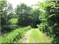
Blocked canal at Moss Side
When the A65 was 'improved', only a towpath tunnel was provided, the canal being infilled.
Image: © John Slater
Taken: 18 Jun 2013
0.05 miles
4

Lancaster Canal
Yes there is more to this square than lazy points grabs on the M6. This is a slightly less lazy grab of a view of the Lancaster Canal from the A65 (taken from outwith a vehicle of course - other people's lives matter!)
Image: © Richard Webb
Taken: 21 Jul 2011
0.06 miles
5
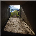
A65 underpass
Looking south along the Lancaster Canal with Bridge 161 in the distance.
When the M6 was built (opened in 1970), the A65 was realigned to link with the motorway at Junction 36 (and the yet to be built A590 eastern extension). The old A65 did not cross the Lancaster Canal, but ran along its eastern side.
The canal was blocked by the A65 (and the M6 in 3 other places), although water passes through in a culvert. This enables the main water supply (Killington Reservoir) to continue to maintain the level in the navigable section further south.
The underpass links the towpath on each side. See Image
Image: © Ian Taylor
Taken: 7 Feb 2015
0.06 miles
6
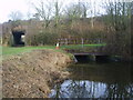
Moss Side Culvert
The old canal abused again at Moss Side Culvert (Bridge 162) which takes it under the A65. The towpath runs through the tunnel in shot which had it been made bigger could have taken the whole canal intact under the road.
Image: © Michael Graham
Taken: 4 Feb 2010
0.09 miles
7

Lancaster Canal
Approaching Millness, the peaceful scene shortly to be violated by the M6.
Image: © Michael Graham
Taken: 4 Feb 2010
0.11 miles
8
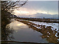
Lancaster canal from the Moss Side culvert
A section of the Lancaster canal, taken while standing on top of the Moss Side culvert which ends this canal section. The canal is disused, but the footpath (the old towpath) is in good order.
Image: © Salford Sal
Taken: 29 Dec 2009
0.11 miles
9
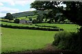
Public Footpath heading towards Dove House Farm
Initially a muddy path beside the hedge, before crossing green pastures to the farm.
Image: © Chris Heaton
Taken: 17 Aug 2022
0.12 miles