
IMAGES TAKEN NEAR TO
Bankside, MILLOM, LA18 5BQ
Introduction
This page details the photographs taken nearby to Bankside, LA18 5BQ by members of the Geograph project.
The Geograph project started in 2005 with the aim of publishing, organising and preserving representative images for every square kilometre of Great Britain, Ireland and the Isle of Man.

There are currently over 7.5m images from over14,400 individuals and you can help contribute to the project by visiting https://www.geograph.org.uk
Image Map
Images are licensed for reuse under creativecommons.org/licenses/by-sa/2.0
Notes
- Clicking on the map will re-center to the selected point.
- The higher the marker number, the further away the image location is from the centre of the postcode.
Image Listing (129 Images Found)
Images are licensed for reuse under creativecommons.org/licenses/by-sa/2.0
Image
Details
Distance
2
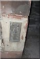
Ordnance Survey Flush Bracket (S7104)
This OS Flush Bracket can be found on the SW face of the Old Police Station. It marks a point 8.789m above mean sea level.
Image: © Adrian Dust
Taken: 7 Jun 2016
0.06 miles
3
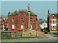
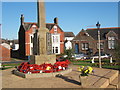
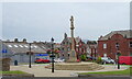
Millom War Memorial
Erected after the first World War (c.1920), it is a grade II listed structure. The figure is St. Michael, sculptor Alec Miller. For a closer view see http://www.geograph.org.uk/photo/540541
Cumbrian War Memorials blog has a photograph of the unveiling ceremony http://cumbrianwarmemorials.blogspot.com/2008/01/unveiling-of-millom-memorial.html .
The building behind the memorial is the Masonic Hall.
Image: © Rose and Trev Clough
Taken: 14 Apr 2007
0.07 miles
4
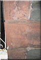
Ordnance Survey Cut Mark
This OS cut mark can be found on the SE face of Fairview, a house on Salthouse Road. It marks a point 8.336m above mean sea level.
Image: © Adrian Dust
Taken: 7 Jun 2016
0.08 miles
5
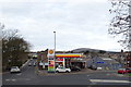
Service station, Millom
On St George's Road.
Image: © JThomas
Taken: 16 Nov 2019
0.08 miles
7
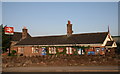
Millom Station - Cumbrian Coast Line
Millom Station which also provides access to Millom Discovery Centre.
This station is on the Cumbrian Coast Line with links to Barrow-in-Furness to the south and Carlisle to the north.
Image: © Andy Deacon
Taken: 22 Aug 2013
0.08 miles
8
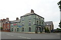
The Station Hotel, Millom
On Salthouse Road.
Image: © JThomas
Taken: 3 Jul 2021
0.09 miles

10
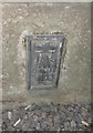
Ordnance Survey Flush Bracket (S7103)
This OS Flush Bracket can be found on the NW face of the Old Cinema. It marks a point 10.524m above mean sea level.
Image: © Adrian Dust
Taken: 7 Jun 2016
0.09 miles