
IMAGES TAKEN NEAR TO
Silecroft, MILLOM, LA18 4NS
Introduction
This page details the photographs taken nearby to LA18 4NS by members of the Geograph project.
The Geograph project started in 2005 with the aim of publishing, organising and preserving representative images for every square kilometre of Great Britain, Ireland and the Isle of Man.

There are currently over 7.5m images from over14,400 individuals and you can help contribute to the project by visiting https://www.geograph.org.uk
Image Map
Images are licensed for reuse under creativecommons.org/licenses/by-sa/2.0
Notes
- Clicking on the map will re-center to the selected point.
- The higher the marker number, the further away the image location is from the centre of the postcode.
Image Listing (20 Images Found)
Images are licensed for reuse under creativecommons.org/licenses/by-sa/2.0
Image
Details
Distance
1
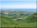
Silecroft and Kirsanton from Black Combe
Vantage point is about half way to the summit of Black Combe. Walney Island just visible in the distance.
Image: © Andy Deacon
Taken: 2 Jul 2011
0.01 miles
2

Silecroft railway station, Cumbria
Opened in 1850 by the Whitehaven & Furness Junction Railway on the line from Barrow-in-Furness to Carlisle. View north west towards Bootle (Cumbria) and Carlisle.
Image: © Nigel Thompson
Taken: 13 Jul 2013
0.05 miles
3
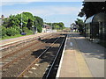
Silecroft railway station, Cumbria
Opened in 1850 by the Whitehaven & Furness Junction Railway on the line from Barrow-in-Furness to Carlisle. View south east towards Millom and Barrow.
Image: © Nigel Thompson
Taken: 13 Jul 2013
0.05 miles

5

Ordnance Survey Cut Mark
This OS cut mark can be found on the Signal Box. It marks a point 11.7226m above mean sea level.
Image: © Adrian Dust
Taken: 16 Oct 2019
0.05 miles

7
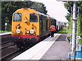
Silecroft goods trade
An "up" train of reprocessed nuclear material from BNFL at Sellafield (perhaps destined for a Polaris refit at nearby Barrow shipyard) awaits a green light at Silecroft station. The spectacular Furness line from Barrow to Carlisle might have disappeared long ago but for Sellafield's economic significance in West Cumbria.
Image: © Andrew Woodhall
Taken: 30 Aug 2001
0.06 miles
8
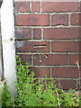
OS benchmark - Silecroft Signal Box
An OS cutmark on the signal box beside the crossing. It faces the road but is somewhat hidden behind the fence. Originally levelled at 11.723m above Ordnance Datum Newlyn.
Image: © Richard Law
Taken: 17 May 2014
0.06 miles
9
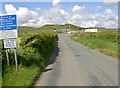
Level railway crossing near to Silecroft
On the minor road going west from Haverigg.
Image: © Steve Fareham
Taken: 28 May 2010
0.06 miles
10

Down mineral empties at Silecroft, 1966
View SE towards Barrow-in-Furness, with Stanier Class 5 4-6-0 No. 45450 (built 12/37, withdrawn 11/67). The sea is just over to the right.
Image: © Ben Brooksbank
Taken: 3 Oct 1966
0.09 miles