
IMAGES TAKEN NEAR TO
Kirksanton, MILLOM, LA18 4NP
Introduction
This page details the photographs taken nearby to LA18 4NP by members of the Geograph project.
The Geograph project started in 2005 with the aim of publishing, organising and preserving representative images for every square kilometre of Great Britain, Ireland and the Isle of Man.

There are currently over 7.5m images from over14,400 individuals and you can help contribute to the project by visiting https://www.geograph.org.uk
Image Map
Images are licensed for reuse under creativecommons.org/licenses/by-sa/2.0
Notes
- Clicking on the map will re-center to the selected point.
- The higher the marker number, the further away the image location is from the centre of the postcode.
Image Listing (18 Images Found)
Images are licensed for reuse under creativecommons.org/licenses/by-sa/2.0
Image
Details
Distance
1

Coming into Kirksanton
A section of the A5093 coastal road which runs from Millom, through Kirksanton, and out again towards Silecroft.
Image: © Richard Law
Taken: 17 May 2014
0.05 miles
2
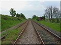
From one level crossing to another
Along a short stretch of the Cumbria Coastal line, taken from the point where the footpath over Lacra Bank shares vehicular access with the track to the lone cottage at the foot of the hill.
Image: © Richard Law
Taken: 20 May 2014
0.05 miles
3
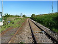
Cumbria Coastal Line towards Ravenglass
Image: © Richard Law
Taken: 17 May 2014
0.07 miles
4

Flush Bracket - Kirksanton
OS flush bracket G3084 on a small outbuilding of one of the houses in the centre of the village. Originally levelled in 1954 at a whopping 9.312m above Ordnance Datum Newlyn.
Image: © Richard Law
Taken: 17 May 2014
0.07 miles
5
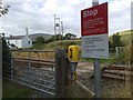
Small level crossing, Cumbria Coast Line
This level crossing provides access for walkers to the public footpath and vehicles needing to get to the white house on the left. This house also has its own private crossing point for pedestrians.
This photograph was taken on a Sunday, hence the line was closed.
Image: © Andy Deacon
Taken: 18 Aug 2013
0.08 miles
6
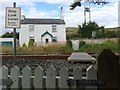
Private pedestrian level crossing Cumbria Coast Line
Small private level crossing to house. There is a public level crossing to the east that enables vehicles to access this house and pedestrians to get onto the public footpath. Image
Image: © Andy Deacon
Taken: 18 Aug 2013
0.09 miles
8

Isolated on the NE side of the railway
A lone cottage on the far side of the railway from the rest of Kirksanton; there is a private level crossing for access, but also a public footpath runs pretty much right through the garden.
Image: © Richard Law
Taken: 20 May 2014
0.09 miles

