
IMAGES TAKEN NEAR TO
Lonsdale Road, MILLOM, LA18 4AS
Introduction
This page details the photographs taken nearby to Lonsdale Road, LA18 4AS by members of the Geograph project.
The Geograph project started in 2005 with the aim of publishing, organising and preserving representative images for every square kilometre of Great Britain, Ireland and the Isle of Man.

There are currently over 7.5m images from over14,400 individuals and you can help contribute to the project by visiting https://www.geograph.org.uk
Image Map
Images are licensed for reuse under creativecommons.org/licenses/by-sa/2.0
Notes
- Clicking on the map will re-center to the selected point.
- The higher the marker number, the further away the image location is from the centre of the postcode.
Image Listing (21 Images Found)
Images are licensed for reuse under creativecommons.org/licenses/by-sa/2.0
Image
Details
Distance
1

High tide over the marshes, outlet to Duddon Estuary near Millom
Only the highest tides cover this area.
Image: © Andrew Hill
Taken: 26 Dec 2007
0.14 miles
2

Saltmarsh adjoining Millom
Within forty minutes of the previous picture, the tide had receded to reveal the normal view.
Image: © Andrew Hill
Taken: 26 Dec 2007
0.15 miles
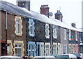
4
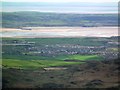
Millom Town
Sometimes you have to take the high ground! From Gray Stones Black Combe: Millom Town, Duddon Estuary, Furness Peninsula.
Image: © Perry Dark
Taken: 15 Apr 2012
0.19 miles
5
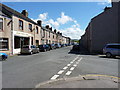
Newton Street, Millom
Houses and a hairdressing salon to the east of the town centre
Image: © Richard Law
Taken: 21 May 2014
0.20 miles
6
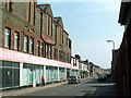
Old Co-operative Society building
Large empty premises in Wellington Street, dating from Millom's more prosperous days.
For closer view see http://www.geograph.org.uk/photo/2187815 .
Image: © Rose and Trev Clough
Taken: 14 Apr 2007
0.20 miles
7
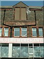
Millom Co-operative Society, carved name stone
Front view of Image .
Image: © Rose and Trev Clough
Taken: 14 Apr 2007
0.20 miles

9
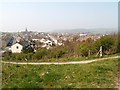
Path up slag heap
A great hill of waste created by Millom Ironworks (in operation 1860s-1968), now part of a nature reserve - see Image .
Looking down on Newton Street (left) and Wellington Street (centre).
Image: © Rose and Trev Clough
Taken: 14 Apr 2007
0.21 miles
10
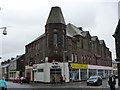
Building on the corner of Wellington Street and Crown Street, Millom
Image: © Alexander P Kapp
Taken: 13 Apr 2011
0.21 miles