
IMAGES TAKEN NEAR TO
Teal Close, ASKAM-IN-FURNESS, LA16 7JF
Introduction
This page details the photographs taken nearby to Teal Close, LA16 7JF by members of the Geograph project.
The Geograph project started in 2005 with the aim of publishing, organising and preserving representative images for every square kilometre of Great Britain, Ireland and the Isle of Man.

There are currently over 7.5m images from over14,400 individuals and you can help contribute to the project by visiting https://www.geograph.org.uk
Image Map
Images are licensed for reuse under creativecommons.org/licenses/by-sa/2.0
Notes
- Clicking on the map will re-center to the selected point.
- The higher the marker number, the further away the image location is from the centre of the postcode.
Image Listing (8 Images Found)
Images are licensed for reuse under creativecommons.org/licenses/by-sa/2.0
Image
Details
Distance
1
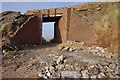
Askam Pier
The bridge at the landward end, which maintains access at beach level. According to old maps, the bridge carried a mineral railway which presumably transported the slag from the steelworks to build the pier, and was later used to import iron ore when local sources ran out.
Image: © Ian Taylor
Taken: 8 Mar 2014
0.08 miles
2
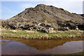
Slag tip, Askam-in-Furness
Slag from the steelworks, which operated from about 1850 to 1918, and had 4 blast furnaces. This area had the second largest deposit of iron ore (hematite) in the country.
Image: © Ian Taylor
Taken: 8 Mar 2014
0.08 miles
3
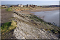
Askam Pier
The south side of the pier at the landward end. Note the sandy beach - there is salt marsh on the north side.
The houses in the background are built on the site of the steelworks.
Image: © Ian Taylor
Taken: 8 Mar 2014
0.12 miles
4
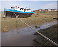
Old tug, Askam-in-Furness
Severn Iris is a tug originally built at Falmouth in 1905. See http://www.nationalhistoricships.org.uk/register/2483/severn-iris
Image: © Ian Taylor
Taken: 8 Mar 2014
0.12 miles
5
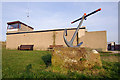
Duddon Inshore Rescue station
A local charity. See http://www.duddon-inshore-rescue.com/
Image: © Ian Taylor
Taken: 8 Mar 2014
0.12 miles
6
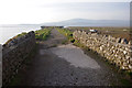
Askam Pier
Looking along the pier from the bridge at the landward end.
The pier was built using slag from the steelworks, presumably transported by railway wagons.
A hazy Black Combe is in the distance.
Image: © Ian Taylor
Taken: 8 Mar 2014
0.12 miles
7
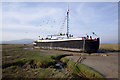
Mersey barge, Askam-in-Furness
Oakdale is a Mersey Flat grain barge built at Runcorn in 1951. See http://www.nationalhistoricships.org.uk/register/2024/oakdale
Image: © Ian Taylor
Taken: 8 Mar 2014
0.17 miles
8

Foreshore, Askam-in-Furness
The salt marsh on the north side of the pier, viewed from the pier. Presumably, the marsh built up after the pier was built - there is a sandy beach to the south.
Image: © Ian Taylor
Taken: 8 Mar 2014
0.23 miles