
IMAGES TAKEN NEAR TO
Alderman Road, LANCASTER, LA1 5FW
Introduction
This page details the photographs taken nearby to Alderman Road, LA1 5FW by members of the Geograph project.
The Geograph project started in 2005 with the aim of publishing, organising and preserving representative images for every square kilometre of Great Britain, Ireland and the Isle of Man.

There are currently over 7.5m images from over14,400 individuals and you can help contribute to the project by visiting https://www.geograph.org.uk
Image Map
Images are licensed for reuse under creativecommons.org/licenses/by-sa/2.0
Notes
- Clicking on the map will re-center to the selected point.
- The higher the marker number, the further away the image location is from the centre of the postcode.
Image Listing (33 Images Found)
Images are licensed for reuse under creativecommons.org/licenses/by-sa/2.0
Image
Details
Distance
1
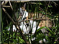
Panthera scotforthicus
A rare outdoor sighting of the Scotforth panther. Sadly, 'Wizzy' is no longer. Born ca 1993, died 21st January, 2011. Gone to where the sun always shines.
Image: © Karl and Ali
Taken: 25 May 2009
0.04 miles
2
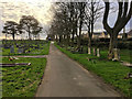
Scotforth Cemetery
Scotforth Cemetery is one of seven cemeteries operated by Lancaster City Council. The site, which occupies a total area of approximately 11 acres containing areas of consecrated and non-consecrated burial ground, is located approximately 3km south of Lancaster city centre and is surrounded by agricultural land and residential properties. It has areas for Church of England, Non-Conformist and Roman Catholic burials. The cemetery also has a section available for Muslim burials and a further section for Polish burials. The first burial at the cemetery took place on 17 January 1891.
Image: © David Dixon
Taken: 15 Mar 2019
0.05 miles
3
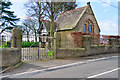
Chapel, Scotforth Cemetery
Scotforth Cemetery is one of seven cemeteries operated by Lancaster City Council. The site, which occupies a total area of approximately 11 acres containing areas of consecrated and non-consecrated burial ground, is located approximately 3km south of Lancaster city centre and is surrounded by agricultural land and residential properties. It has areas for Church of England, Non-Conformist and Roman Catholic burials. The cemetery also has a section available for Muslim burials and a further section for Polish burials.
The single, non-denominational chapel is at the north-west corner of the cemetery. It dates from 1891 (the year the cemetery first opened).
Image: © David Dixon
Taken: 17 Mar 2019
0.06 miles
4
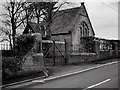
Scotforth Cemetery Chapel
Scotforth Cemetery is one of seven cemeteries operated by Lancaster City Council. The site, which occupies a total area of approximately 11 acres containing areas of consecrated and non-consecrated burial ground, is located approximately 3km south of Lancaster city centre and is surrounded by agricultural land and residential properties. It has areas for Church of England, Non-Conformist and Roman Catholic burials. The cemetery also has a section available for Muslim burials and a further section for Polish burials.
The single, non-denominational chapel is at the north-west corner of the cemetery. It dates from 1891 (the year the cemetery first opened).
Image: © David Dixon
Taken: 15 Mar 2019
0.06 miles
5
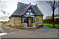
Chapel at Scotforth Cemetery
Scotforth Cemetery is one of seven cemeteries operated by Lancaster City Council. The site, which occupies a total area of approximately 11 acres containing areas of consecrated and non-consecrated burial ground, is located approximately 3km south of Lancaster city centre and is surrounded by agricultural land and residential properties. It has areas for Church of England, Non-Conformist and Roman Catholic burials. The cemetery also has a section available for Muslim burials and a further section for Polish burials.
The single, non-denominational chapel is at the north-west corner of the cemetery. It dates from 1891 (the year the cemetery first opened).
Image: © David Dixon
Taken: 15 Mar 2019
0.06 miles
6
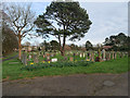
Cemetery at Scotforth
Scotforth Cemetery is one of seven cemeteries operated by Lancaster City Council. The site, which occupies a total area of approximately 11 acres containing areas of consecrated and non-consecrated burial ground, is located approximately 3km south of Lancaster city centre and is surrounded by agricultural land and residential properties. It has areas for Church of England, Non-Conformist and Roman Catholic burials. The cemetery also has a section available for Muslim burials and a further section for Polish burials. The first burial at the cemetery took place on 17 January 1891.
Image: © David Dixon
Taken: 15 Mar 2019
0.07 miles
7
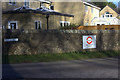
Piccadilly, Scotforth, Lancaster
The London-Underground style sign is for Piccadilly Garden and Support Services, an organisation catering for children and adults with special educational needs.
Image: © Robert Eva
Taken: 28 Jan 2019
0.07 miles
8
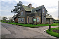
Entrance Lodge at Scotforth Cemetery
Scotforth Cemetery is one of seven cemeteries operated by Lancaster City Council. The site, which occupies a total area of approximately 11 acres containing areas of consecrated and non-consecrated burial ground, is located approximately 3km south of Lancaster city centre and is surrounded by agricultural land and residential properties. It has areas for Church of England, Non-Conformist and Roman Catholic burials. The cemetery also has a section available for Muslim burials and a further section for Polish burials. The first burial at the cemetery took place on 17 January 1891.
Image: © David Dixon
Taken: 15 Mar 2019
0.08 miles
10
Scotforth Cemetery (2)
Commonwealth war graves
Image: © Ian Greig
Taken: 7 Aug 2019
0.10 miles