
Chapel at Scotforth Cemetery
Introduction
The photograph on this page of Chapel at Scotforth Cemetery by David Dixon as part of the Geograph project.
The Geograph project started in 2005 with the aim of publishing, organising and preserving representative images for every square kilometre of Great Britain, Ireland and the Isle of Man.

There are currently over 7.5m images from over 14,400 individuals and you can help contribute to the project by visiting https://www.geograph.org.uk
Chapel at Scotforth Cemetery
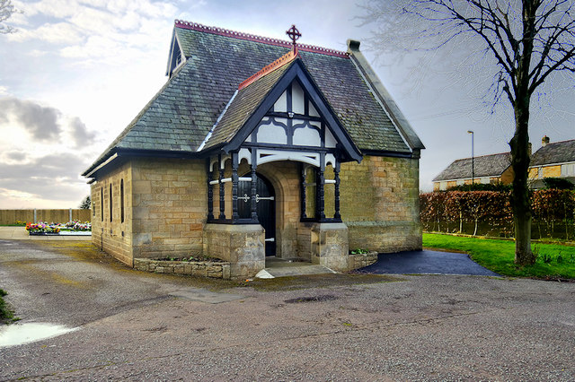
Image: © David Dixon Taken: 15 Mar 2019
Scotforth Cemetery is one of seven cemeteries operated by Lancaster City Council. The site, which occupies a total area of approximately 11 acres containing areas of consecrated and non-consecrated burial ground, is located approximately 3km south of Lancaster city centre and is surrounded by agricultural land and residential properties. It has areas for Church of England, Non-Conformist and Roman Catholic burials. The cemetery also has a section available for Muslim burials and a further section for Polish burials. The single, non-denominational chapel is at the north-west corner of the cemetery. It dates from 1891 (the year the cemetery first opened).
Images are licensed for reuse under creativecommons.org/licenses/by-sa/2.0
Image Location

Latitude
54.028266
Longitude
-2.802939