IMAGES TAKEN NEAR TO
Queen Street, DALTON-IN-FURNESS, LA15 8EH
Introduction
This page details the photographs taken nearby to Queen Street, LA15 8EH by members of the Geograph project.
The Geograph project started in 2005 with the aim of publishing, organising and preserving representative images for every square kilometre of Great Britain, Ireland and the Isle of Man.

There are currently over 7.5m images from over14,400 individuals and you can help contribute to the project by visiting https://www.geograph.org.uk
Image Map
Images are licensed for reuse under creativecommons.org/licenses/by-sa/2.0
Notes
- Clicking on the map will re-center to the selected point.
- The higher the marker number, the further away the image location is from the centre of the postcode.
Image Listing (47 Images Found)
Images are licensed for reuse under creativecommons.org/licenses/by-sa/2.0
Image
Details
Distance
1
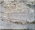
Ordnance Survey Cut Mark
This OS cut mark can be found on the wall SE side of Broughton Road. It marks a point 42.612m above mean sea level.
Image: © Adrian Dust
Taken: 15 Oct 2019
0.04 miles
2
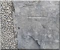
Ordnance Survey Cut Mark
This OS cut mark can be found on No3 Ainslie Street. It marks a point 44.274m above mean sea level.
Image: © Adrian Dust
Taken: 15 Oct 2019
0.07 miles
3
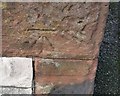
Ordnance Survey Cut Mark
This OS cut mark can be found on the NE angle of the Baptist Chapel. It marks a point 40.996m above mean sea level.
Image: © Adrian Dust
Taken: 15 Oct 2019
0.07 miles
4

Seventh-day Adventist Church, Barrow, Sign
Image: © Alexander P Kapp
Taken: 17 Aug 2005
0.08 miles
5
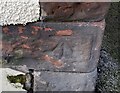
Ordnance Survey Cut Mark
This OS cut mark can be found on No9 Ashworth Street. It marks a point 47.129m above mean sea level.
Image: © Adrian Dust
Taken: 15 Oct 2019
0.08 miles
6

Bakery in a former church, Dalton-in-Furness
This former ecclesiastical building on Broughton Road has been re-purposed as a bakery.
Image: © Graham Robson
Taken: 3 Nov 2014
0.08 miles
7

Seventh-day Adventist Church, Barrow
Image: © Alexander P Kapp
Taken: 17 Aug 2005
0.08 miles
8
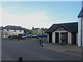
Toilets and car park, Dalton-in-Furness
The public toilets and car park on Broughton Road, near Tudor Square, in the centre of Dalton. A public telephone box stands in front of the toilets.
Image: © Graham Robson
Taken: 3 Nov 2014
0.09 miles
9
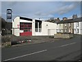
Former Fire Station, Dalton-in-Furness
The former fire station in Dalton. The building closed (and Dalton lost its fire station) in July 2014 http://www.nwemail.co.uk/news/closed-dalton-fire-station-will-be-sold-to-highest-bidder-1.1154576 as a result of a restructuring of the service following budget cuts.
Image: © Graham Robson
Taken: 3 Nov 2014
0.09 miles