
IMAGES TAKEN NEAR TO
Chapel Street, DALTON-IN-FURNESS, LA15 8BY
Introduction
This page details the photographs taken nearby to Chapel Street, LA15 8BY by members of the Geograph project.
The Geograph project started in 2005 with the aim of publishing, organising and preserving representative images for every square kilometre of Great Britain, Ireland and the Isle of Man.

There are currently over 7.5m images from over14,400 individuals and you can help contribute to the project by visiting https://www.geograph.org.uk
Image Map
Images are licensed for reuse under creativecommons.org/licenses/by-sa/2.0
Notes
- Clicking on the map will re-center to the selected point.
- The higher the marker number, the further away the image location is from the centre of the postcode.
Image Listing (93 Images Found)
Images are licensed for reuse under creativecommons.org/licenses/by-sa/2.0
Image
Details
Distance
1
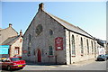
Dalton in Furness Methodist Church
Image: © Alexander P Kapp
Taken: 17 Aug 2005
0.02 miles
2
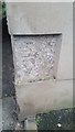
Ordnance Survey Cut Mark
This OS cut mark can be found on the Lord Nelson. It marks a point 114.9ft above mean sea level.
Image: © Adrian Dust
Taken: 15 Oct 2019
0.02 miles
3
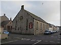
Methodist Church, Dalton-in-Furness
Dalton Methodist Church on Chapel Street on the corner of Chapel Street and Wellington Street.
Image: © Graham Robson
Taken: 3 Nov 2014
0.03 miles
4
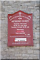
Dalton-in-Furness Methodist Church, Sign
Image: © Alexander P Kapp
Taken: 17 Aug 2005
0.03 miles
5
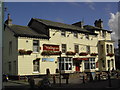
The Wellington
The Wellington public house, Market Street, Dalton in Furness.
Image: © Colin Kinnear
Taken: 16 Sep 2009
0.04 miles
6
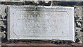
Inscribed stone, Former Wesleyan Sunday School, Dalton-in-Furness
The inscribed stone on the facade of the grade II listed former Wesleyan Sunday School in Dalton gives the date of the building as 1896.
Image: © Graham Robson
Taken: 3 Nov 2014
0.05 miles
7
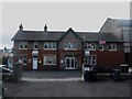
Dalton-in-Furness Drill Hall
The drill hall is located on Nelson Street in Dalton. The building is now used for various community purposes including the office of the local police officers in the town.
Image: © Graham Robson
Taken: 3 Nov 2014
0.05 miles
8
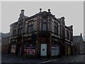
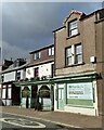
Former pub, Dalton-in-Furness
This building appears to have recently been a pub, but looks like it has found a new life as a fitness club or gym. When I visited the exterior looked as if it needed a bit of T.L.C.
Image: © Graham Robson
Taken: 3 Nov 2014
0.06 miles
10
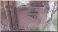
Ordnance Survey Cut Mark
This OS cut mark can be found at the junction of Nelson Street & Chapel Street. It marks a point 33.686m above mean sea level.
Image: © Adrian Dust
Taken: 15 Oct 2019
0.06 miles