
IMAGES TAKEN NEAR TO
Gregson Road, LANCASTER, LA1 3DJ
Introduction
This page details the photographs taken nearby to Gregson Road, LA1 3DJ by members of the Geograph project.
The Geograph project started in 2005 with the aim of publishing, organising and preserving representative images for every square kilometre of Great Britain, Ireland and the Isle of Man.

There are currently over 7.5m images from over14,400 individuals and you can help contribute to the project by visiting https://www.geograph.org.uk
Image Map
Images are licensed for reuse under creativecommons.org/licenses/by-sa/2.0
Notes
- Clicking on the map will re-center to the selected point.
- The higher the marker number, the further away the image location is from the centre of the postcode.
Image Listing (168 Images Found)
Images are licensed for reuse under creativecommons.org/licenses/by-sa/2.0
Image
Details
Distance

2

Lancaster Royal Grammar School
The old school building on East Road. Moorgate runs downhill on the right. Building on this site started in 1851. The school has subsequently extended across the road and further up the hill.
Comparison with an 1896 photograph (http://www.francisfrith.com/lancaster/photos/the-grammar-school-1896_37373/ ), shows that little has changed externally.
(See Image for a detail view, and Image for a view of the lower section of this block.)
Image: © Ian Taylor
Taken: 13 Mar 2010
0.04 miles
3

House and school, Moorgate, Lancaster
This is the top end of Moorgate, where it meets east Road. The school is now St Martin's pre-school centre.
Image: © Humphrey Bolton
Taken: 20 Dec 2007
0.05 miles
4

Britannia, Ullswater Road, Lancaster
Image: © Alexander P Kapp
Taken: 3 Sep 2008
0.05 miles
5

Lancaster Royal Grammar School
The old school building on East Road. Building on this site started in 1851. The school has subsequently extended across the road and further up the hill.
(See Image for a detail view, and Image for a view of the upper section of this block.)
Image: © Ian Taylor
Taken: 13 Mar 2010
0.05 miles
6

Lancaster
The junction of East Road and Moor Lane in Lancaster.
Image: © Peter McDermott
Taken: 30 Dec 2014
0.05 miles
7

OS Bench Mark
OS cut bench mark from the 19th century levelling, on the corner of Christ Church, Lancaster, with the war memorial in the background. 219.7 feet above old datum.
Image: © Phil Johnstone
Taken: 16 Aug 2021
0.06 miles
8
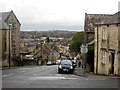
Moorgate, Lancaster
Looking along Moorgate a residential street close to Lancaster city centre.
Image: © Graham Robson
Taken: 8 Nov 2013
0.06 miles
9

OS Bench Mark
OS cut bench mark from the 19th century levelling, on a roadside wall of the Lancaster Royal Grammar School.
Image: © Phil Johnstone
Taken: 1 Aug 2021
0.07 miles
10

Doorway, Lancaster Grammar School, East Road, Lancaster
The school seems to spread out in several buildings. This looks to be one of the original buildings of 1852, when the school moved to this side of the town.
Image: © Humphrey Bolton
Taken: 20 Dec 2007
0.07 miles