
IMAGES TAKEN NEAR TO
Carter Road, GRANGE-OVER-SANDS, LA11 7AG
Introduction
This page details the photographs taken nearby to Carter Road, LA11 7AG by members of the Geograph project.
The Geograph project started in 2005 with the aim of publishing, organising and preserving representative images for every square kilometre of Great Britain, Ireland and the Isle of Man.

There are currently over 7.5m images from over14,400 individuals and you can help contribute to the project by visiting https://www.geograph.org.uk
Image Map
Images are licensed for reuse under creativecommons.org/licenses/by-sa/2.0
Notes
- Clicking on the map will re-center to the selected point.
- The higher the marker number, the further away the image location is from the centre of the postcode.
Image Listing (34 Images Found)
Images are licensed for reuse under creativecommons.org/licenses/by-sa/2.0
Image
Details
Distance
2

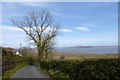
Kents Bank
Seen from the promenade at Grange.
Image: © David M Clark
Taken: 17 May 2026
0.09 miles
3
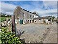
Guides Farm
700-year old Grade II listed building owned by the Crown which is traditionally occupied by the official guide for the crossing of the sands of the Kent estuary.
Image: © Oliver Dixon
Taken: 21 Apr 2024
0.09 miles
4
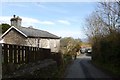
Carter Road meets Cart Lane
Looking down the last few yards of Carter Road towards Cart Lane. The railway line is just ahead.
Image: © DS Pugh
Taken: 25 Mar 2016
0.09 miles
5
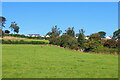
Near Guide Farm
View from the footpath near Kents Bank.
Image: © Wayland Smith
Taken: 28 Aug 2021
0.09 miles
6
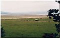
Morecambe Bay crossing
The line of walkers with the Land Rover have just completed a crossing of the quicksands of the bay.
Arnside from where they started is way over to the left.
Image: © Jack Hill
Taken: 23 Jan 2000
0.10 miles
7
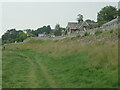
Railway embankment, south of Grange-over-Sands
Built out to accommodate a level crossing and a slipway down to the 'beach'.
Image: © Christine Johnstone
Taken: 7 Jun 2021
0.11 miles
8
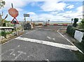
Carter Road crossing
Level crossing over the Cumbrian Coast line down onto the saltmarsh adjacent to the Kent estuary.
Image: © Oliver Dixon
Taken: 21 Apr 2024
0.11 miles
9
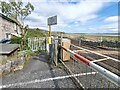
Cumbrian Coast line
At the Carter Road crossing down onto the saltmarsh adjacent to the Kent estuary.
Image: © Oliver Dixon
Taken: 21 Apr 2024
0.11 miles
10
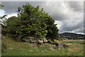
The foreshore between Grange and Kents Bank
The saltmarsh ends in a series of limestone outcrops like the one here, which is topped by an ash tree. The proximity of the Furness Railway line is apparent by the rear of the colour light signal. In the distance the promenade at Grange over Sands is seen.
Image: © K A
Taken: 23 Jul 2011
0.13 miles