
IMAGES TAKEN NEAR TO
Bowland Bridge, GRANGE-OVER-SANDS, LA11 6NN
Introduction
This page details the photographs taken nearby to LA11 6NN by members of the Geograph project.
The Geograph project started in 2005 with the aim of publishing, organising and preserving representative images for every square kilometre of Great Britain, Ireland and the Isle of Man.

There are currently over 7.5m images from over14,400 individuals and you can help contribute to the project by visiting https://www.geograph.org.uk
Image Map
Images are licensed for reuse under creativecommons.org/licenses/by-sa/2.0
Notes
- Clicking on the map will re-center to the selected point.
- The higher the marker number, the further away the image location is from the centre of the postcode.
Image Listing (21 Images Found)
Images are licensed for reuse under creativecommons.org/licenses/by-sa/2.0
Image
Details
Distance
1

Bowland Bridge from the Mason's Arms
Bowland Bridge, viewed from the Mason's Arms pub on Strawberry Bank. The pub had great outdoor heaters fitted under the table umbrellas! Lovely hour spent there!
Image: © mezmrz
Taken: 9 Oct 2005
0.01 miles

3

Bowland Bridge Village
A quiet Sunday afternoon in Bowland Bridge
Image: © mezmrz
Taken: 9 Oct 2005
0.01 miles
4

Bowland Bridge Village
Well the Post Office is still open, even after the closures
Image: © Alexander P Kapp
Taken: 3 Jul 2008
0.02 miles
5

Hare & Hounds, Bowland Bridge
On a very wet day
Image: © Tom Richardson
Taken: 18 Jan 2010
0.02 miles
6

Bowland Bridge
Seen from the Masons Arms pub on Strawberry Bank.
Image: © David Purchase
Taken: 24 Jul 2013
0.03 miles
7

Smithy Lane and Bowland Bridge
Looking across Smithy Lane with Bowland Bridge on the left. The county boundary follows the River Winster under the bridge, which has a name stone and two boundary stones.
Image: © John S Turner
Taken: 26 May 2012
0.05 miles
8
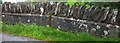
Boundary stone, Bowland Bridge
When these two carved slabs were built into the bridge this was the county boundary between Westmorland (spelt 'Westmoreland') and Lancashire. Since 1974 the whole area has been metamorphosed into the make believe county of Cumbria and the River Winster merely separates the parishes of Cartmel Fell and Crosthwaite & Lyth.
Image: © Karl and Ali
Taken: 19 Jul 2012
0.06 miles
9

Crosthwaite & Lyth boundary stone on Bowland Bridge
There are two county boundary stones on the south parapet of Bowland Bridge, which spans the River Winster. This stone is on the eastern side of the bridge and carries the inscription 'Crosthwaite & Lyth Westmoreland'.
Milestone Society National ID: WE_CROS01pb
Image: © John S Turner
Taken: 26 May 2012
0.06 miles
10

Bowland Bridge and its boundary stones
Looking across Bowland Bridge towards its boundary stones, which are set into the south parapet. The furthest stone is 'Crosthwaite & Lyth Westmoreland' Image and the nearest stone is 'Cartmel Fell Lancashire' Image The county boundary follows the River Winster, which flows under the bridge.
Image: © John S Turner
Taken: 26 May 2012
0.06 miles