
IMAGES TAKEN NEAR TO
Rockwell Gardens, GRANGE-OVER-SANDS, LA11 6DJ
Introduction
This page details the photographs taken nearby to Rockwell Gardens, LA11 6DJ by members of the Geograph project.
The Geograph project started in 2005 with the aim of publishing, organising and preserving representative images for every square kilometre of Great Britain, Ireland and the Isle of Man.

There are currently over 7.5m images from over14,400 individuals and you can help contribute to the project by visiting https://www.geograph.org.uk
Image Map
Images are licensed for reuse under creativecommons.org/licenses/by-sa/2.0
Notes
- Clicking on the map will re-center to the selected point.
- The higher the marker number, the further away the image location is from the centre of the postcode.
Image Listing (49 Images Found)
Images are licensed for reuse under creativecommons.org/licenses/by-sa/2.0
Image
Details
Distance
1

Rockwell Gardens, Grange-Over-Sand
Image: © Alexander P Kapp
Taken: 10 Jun 2008
0.02 miles
2

Valve cover, Charney Well Lane
The inscription is GUDC VALVE, the acronym being Grange Urban District Council. It was made by Blakeborough of Brighouse. For context see Image
Image: © Stephen Craven
Taken: 13 Oct 2020
0.03 miles
3
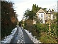
Eden Mount, Grange-over-Sands
An access road leading from Charney Well Lane to Ashmount Road in Grange-over-Sands.
Image: © Adrian Taylor
Taken: 26 Jan 2013
0.03 miles
4

Charney Well Lane
To provide context for Image in the middle of the road.
Image: © Stephen Craven
Taken: 13 Oct 2020
0.04 miles
5

Charney Well
The well is located a few feet behind the alcove in the limestone wall in what is now a private garden. The alcove at one time contained a trough, fed with water from the well.
Image: © Adrian Taylor
Taken: 26 Jan 2013
0.06 miles

7
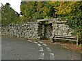
Charney Well
The actual well (spring) is beyond the stone wall in private grounds, but used to feed an animal trough here. See also Image
Image: © Stephen Craven
Taken: 13 Oct 2020
0.07 miles
8

Limestone crag, Eden Mount
There are several limestone outcrops hidden in the woods above Grange. The footpath is cut into a ledge at the base of the largest. There are several rock climbs on this 10m tall outcrop but they are not popular.
Image: © Karl and Ali
Taken: 26 Oct 2011
0.09 miles
9

Eden Mount substation
A substantial installation, presumably the main electrical incomer to Grange-over-Sands.
Image: © Stephen Craven
Taken: 13 Oct 2020
0.10 miles
10

Roe deer on the edge of Eden Mount
These two deer (look left of and beyond the sunlit one!) watched me intently as I followed the footpath around the edge of the wood. As soon as I tried to approach for a closer look they were off. This is a zoom shot cropped close - I wasn't actually right in front of them.
Image: © Karl and Ali
Taken: 26 Oct 2011
0.11 miles