
IMAGES TAKEN NEAR TO
Abingdon Grove, LIVERPOOL, L4 9UZ
Introduction
This page details the photographs taken nearby to Abingdon Grove, L4 9UZ by members of the Geograph project.
The Geograph project started in 2005 with the aim of publishing, organising and preserving representative images for every square kilometre of Great Britain, Ireland and the Isle of Man.

There are currently over 7.5m images from over14,400 individuals and you can help contribute to the project by visiting https://www.geograph.org.uk
Image Map
Images are licensed for reuse under creativecommons.org/licenses/by-sa/2.0
Notes
- Clicking on the map will re-center to the selected point.
- The higher the marker number, the further away the image location is from the centre of the postcode.
Image Listing (19 Images Found)
Images are licensed for reuse under creativecommons.org/licenses/by-sa/2.0
Image
Details
Distance
1
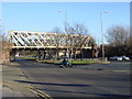
Railway Bridge, Walton Hall Avenue
Iron railway bridge crossing Walton Hall Avenue. This line was always busy with goods trains accessing the docks but a number of passenger services used this line, north to Southport and to the South trains served destinations to Liverpool and to Manchester. The CLC North Liverpool Extension line was always very busy on Grand National days as express trains from all over the country used it to access Aintree Central. The first major service to be withdrawn was the Southport Service which finished on 7th January 1952. A local service from Aintree Central to Manchester with some peak services to Liverpool continued until 7th November 1960. The last goods trains ran in August 1975. Today the route is part of the National Cycleway Network Route 62 which is The Trans Pennine Trail.
Image: © Sue Adair
Taken: 14 Jan 2006
0.10 miles
2

Liverpool: Walton Hall Avenue bridge
This massive girder bridge used to carry the Liverpool Loop railway line over the A580 Walton Hall Avenue. The line was dismantled around 1975, and the footpath created around 1986. Today it carries National Cycle Network Route 62 and the Trans Pennine Trail over the road. Sue's Image shows the bridge from the road.
Image: © Nigel Cox
Taken: 16 Jun 2007
0.10 miles
3
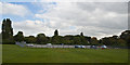
Richard Kelly Field
The Field is in between Richard Kelly Drive and Abingdon Road. To the right is Caspian Road. In the distance is the disused Railway Bridge in Philbeach Road. (Now known as the Cycle Path) underneath the bridge is Norris Green. For many years both Norris Green and Walton locals have used this field for leisure, football being the most popular.
Image: © andy miller
Taken: Unknown
0.11 miles
4
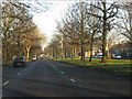
The broad highway east
Typical of the suburban dual carriageways constructed in Liverpool's outer suburbs in the 1920s/30s, Walton Hall Avenue retains its broad main carriageway and wide, tree-lined central reservation. Entirely suitable for its sometime role as the main highway from Liverpool's docks toward the rest of Lancashire. A classic of town planning.
Image: © Peter Whatley
Taken: 17 Jan 2012
0.11 miles
5
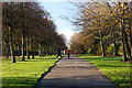
Footpath beside Walton Hall Avenue, Liverpool
Image: © Mike Pennington
Taken: 21 Nov 2015
0.12 miles
7
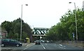
Walton Hall Avenue Bridge Crosses the A580
Image: © Anthony Parkes
Taken: 23 Sep 2012
0.13 miles
8
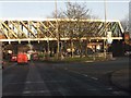
Cheshire Lines railway bridge, Walton Hall Avenue
The redundant bridge which once carried the Southport branch of the Cheshire Lines Committee railway line.
Image: © Peter Whatley
Taken: 17 Jan 2012
0.13 miles
9
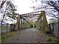
Bridge over Walton Hall Avenue
Similar to the bridge a little further south over Townsend Avenue Image, the reason for this substantial structure is that the railway crossed the dual carriageway Walton Hall Avenue (A580) at this point in a single span of about 45 metres. Therefore a deep truss bridge that contains the stresses within itself gave ore clearance than a traditional arch. See Image for a side view.
Image: © Stephen Craven
Taken: 4 Nov 2017
0.13 miles
10
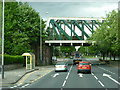
The A580 at Walton Hall Avenue Bridge, Liverpool
Image: © Ian S
Taken: 8 May 2011
0.14 miles