IMAGES TAKEN NEAR TO
Rawson Road, LIVERPOOL, L21 1BT

Introduction

This page details the photographs taken nearby to Rawson Road, L21 1BT by members of the Geograph project.

The Geograph project started in 2005 with the aim of publishing, organising and preserving representative images for every square kilometre of Great Britain, Ireland and the Isle of Man.

There are currently over 7.5m images from over14,400 individuals and you can help contribute to the project by visiting https://www.geograph.org.uk

Image Map


Images are licensed for reuse under creativecommons.org/licenses/by-sa/2.0
Notes
  • Clicking on the map will re-center to the selected point.
  • The higher the marker number, the further away the image location is from the centre of the postcode.

Image Listing (24 Images Found)

Images are licensed for reuse under creativecommons.org/licenses/by-sa/2.0
  • ...
Image
Details
Distance
1
Crosby Road South Flyover
The A5036/A565 (Princess Way/Crosby Road South) junction near Seaforth Docks.
Image: © David Dixon Taken: 8 May 2017
0.12 miles
2
Seaforth flyover
Image: © Ian Greig Taken: 2 Jan 2015
0.13 miles
3
Nautical Landscape Feature near Entrance to Royal Seafoth Docks
The centrepiece of landscaping at the busy A5036/A565 (Princess Way/Crosby Road South) junction near the entrance to the Port of Liverpool Royal Seaforth Dock is a disused navigation buoy. The two metal triangles at the top of the buoy are the "topmark" and their shapes indicate that this was a West Cardinal Mark; meaning that ships should pass to the west of the buoy. It carries the letters G M on this side with the other side marked J C (see Image]).
Image: © David Dixon Taken: 8 May 2017
0.15 miles
4
Buoy on Traffic Island near Entrance to Seaforth Container Terminal
This disused navigation buoy forms the centrepiece of landscaping at the busy A5036/A565 (Princess Way/Crosby Road South) junction near the entrance to the Port of Liverpool Royal Seaforth Dock. The two metal triangles at the top of the buoy are the "topmark" and their shapes indicate that this was a West Cardinal Mark; meaning that ships should pass to the west of the buoy. It carries the letters J C on this side with the other side marked G M (see Image]).
Image: © David Dixon Taken: 8 May 2017
0.15 miles
5
Princess Way - Seaforth
Image: © Anthony Parkes Taken: 23 Sep 2012
0.16 miles
6
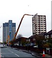
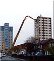
Montgomery House
3 attempts were made to demolish Montgomery House by explosion but all it did was lean over. This machine has now been brought in to take the building down floor by floor
Image: © Norman Caesar Taken: 1 May 2016
0.17 miles
7
Charter train at the Seaforth container terminal
The charter train with Class 66 diesel locomotive number 66063 leading reaches the end of the branch line into the docks
Image: © Roger Templeman Taken: 14 Apr 2012
0.17 miles
8
Montgomery House
3 attempts were made to demolish Montgomery House by explosion but all it did was lean over. This machine has now been brought in to take the building down floor by floor
Image: © Norman Caesar Taken: 1 May 2016
0.17 miles
9
The 'International' Hotel & Public House, Church Road/Crosby Road South, Seaforth, Liverpool L21
Another good example (albeit now in a state of disuse) of Victorian pub' architecture. A popular wartime venue for both local people, service personnel, and seafarers from all parts of the world, hence its name 'The International' pub'. Alas, although the building survived the worst effects of the wartime German bombing of the dockland area, in what was to become known as "The May Blitz 1941", it has become the victim of a combination of the effects of business malaise and 'official' neglect.
Image: © david lawler Taken: 24 Jul 2009
0.17 miles
10
Crosby Road South
Image: © Colin Pyle Taken: 25 Sep 2010
0.18 miles
  • ...