
Buoy on Traffic Island near Entrance to Seaforth Container Terminal
Introduction
The photograph on this page of Buoy on Traffic Island near Entrance to Seaforth Container Terminal by David Dixon as part of the Geograph project.
The Geograph project started in 2005 with the aim of publishing, organising and preserving representative images for every square kilometre of Great Britain, Ireland and the Isle of Man.

There are currently over 7.5m images from over 14,400 individuals and you can help contribute to the project by visiting https://www.geograph.org.uk
Buoy on Traffic Island near Entrance to Seaforth Container Terminal
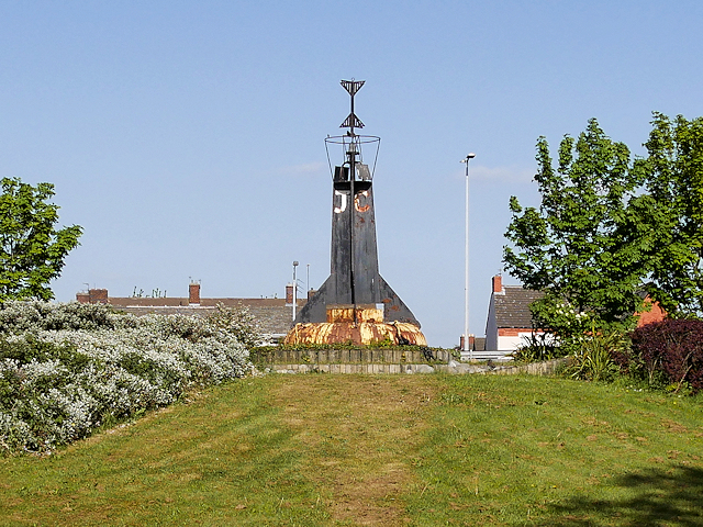
Image: © David Dixon Taken: 8 May 2017
This disused navigation buoy forms the centrepiece of landscaping at the busy A5036/A565 (Princess Way/Crosby Road South) junction near the entrance to the Port of Liverpool Royal Seaforth Dock. The two metal triangles at the top of the buoy are the "topmark" and their shapes indicate that this was a West Cardinal Mark; meaning that ships should pass to the west of the buoy. It carries the letters J C on this side with the other side marked G M (see Image]).
Images are licensed for reuse under creativecommons.org/licenses/by-sa/2.0
Image Location

Latitude
53.465666
Longitude
-3.018232