IMAGES TAKEN NEAR TO
Park Terrace, GLENROTHES, KY7 6BN

Introduction

This page details the photographs taken nearby to Park Terrace, KY7 6BN by members of the Geograph project.

The Geograph project started in 2005 with the aim of publishing, organising and preserving representative images for every square kilometre of Great Britain, Ireland and the Isle of Man.

There are currently over 7.5m images from over14,400 individuals and you can help contribute to the project by visiting https://www.geograph.org.uk

Image Map


Images are licensed for reuse under creativecommons.org/licenses/by-sa/2.0
Notes
  • Clicking on the map will re-center to the selected point.
  • The higher the marker number, the further away the image location is from the centre of the postcode.

Image Listing (19 Images Found)

Images are licensed for reuse under creativecommons.org/licenses/by-sa/2.0
Image
Details
Distance
1
Entrance to Balbirnie Park
A host of golden daffodils.
Image: © James Allan Taken: 19 Mar 2012
0.13 miles
2
Former headquarters of John Haig & Sons whisky
This building is now used as general industrial and office space
Image: © James Allan Taken: 15 Nov 2003
0.16 miles
3
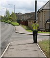
Pop-up Bob!
As the B9130 enters the town of Markinch this is what speeding motorists see - a police officer aiming a speed gun at them! 'Pop-up Bob', as he is known, is a very lifelike plastic cutout of a police officer which is being placed at random locations throughout Fife as part of a speed reduction initiative.
Image: © Bill Kasman Taken: 13 May 2018
0.18 miles
4
Pop-up Bob!
As the B9130 enters the town of Markinch this is what speeding motorists see - a police officer aiming a speed gun at them! 'Pop-up Bob', as he is known, is a very lifelike plastic cutout of a police officer which is being placed at random locations throughout Fife as part of a speed reduction initiative.
Image: © Bill Kasman Taken: 13 May 2018
0.18 miles
5
Balbirnie Park Golf Course, 7th hole, West Markinch
The short downhill seventh hole at Balbirnie Park from tee to green.
Image: © Scott Cormie Taken: 25 Jul 2018
0.19 miles
6
Flooded land in Balbirnie Park, Markinch
Image: © Becky Williamson Taken: 4 Feb 2020
0.19 miles
7
Balbirnie Viaduct Path
Signpost on the path.
Image: © Bill Kasman Taken: 29 Jun 2022
0.20 miles
8
Balbirnie Viaduct Path
The Balbirnie Viaduct Path splits into two here. The left-hand branch goes over the viaduct whilst the right-hand branch continues to Prestonhall and on to Cadham in Glenrothes.
Image: © Bill Kasman Taken: 29 Jun 2022
0.21 miles
9
Markinch
View of Markinch from the Graveyard of Markinch Parish Church, the centre of Markinch was designated a conservation area in 1973.
Image: © Kevin Rae Taken: 20 Feb 2006
0.21 miles
10
Leslie Railway
While the railway branch to Leslie was closed in 1967, this bit is still shown as a railway on my 2002 1:50,000 map and served the paper mills until sometime in the 1990s. It is now a cycle/footpath including the Balbirnie Viaduct.
Image: © Richard Webb Taken: 15 May 2012
0.21 miles