IMAGES TAKEN NEAR TO
High Street, BURNTISLAND, KY3 9BD

Introduction

This page details the photographs taken nearby to High Street, KY3 9BD by members of the Geograph project.

The Geograph project started in 2005 with the aim of publishing, organising and preserving representative images for every square kilometre of Great Britain, Ireland and the Isle of Man.

There are currently over 7.5m images from over14,400 individuals and you can help contribute to the project by visiting https://www.geograph.org.uk

Image Map


Images are licensed for reuse under creativecommons.org/licenses/by-sa/2.0
Notes
  • Clicking on the map will re-center to the selected point.
  • The higher the marker number, the further away the image location is from the centre of the postcode.

Image Listing (155 Images Found)

Images are licensed for reuse under creativecommons.org/licenses/by-sa/2.0
  • ...
Image
Details
Distance
1
Burntisland High Street
Looking west along the High Street to Burntisland Railway Viaduct. Image
Image: © Paul McIlroy Taken: 2 Jun 2007
0.01 miles
2
Silver Tassie
Bar, Burntisland High Street.
Image: © Richard Webb Taken: 25 Apr 2009
0.02 miles
3
Harbour Place, Burntisland
These handsome buildings on Harbour Place are all grade B listed. The main building is the 18th/19th century Smugglers Inn Hotel.
Image: © Oliver Dixon Taken: 23 Mar 2022
0.04 miles
4
Burntisland Viaduct
Image: © kim traynor Taken: 20 Apr 2011
0.04 miles
5
Burntisland viaduct
Burntisland viaduct and Harbour House Image
Image: © Paul McIlroy Taken: 3 May 2007
0.04 miles
6
Site of the former tollbooth, Burntisland
Nothing now remains of the building where 224 Covenanters were imprisoned in May 1685 in deplorable conditions, packed into two rooms in the tollbooth without food or water. They had been shipped to the town from Leith They were then marched all the way to Dunnottar Castle near Stonehaven. For more information, see https://www.burntisland.net/churches-article4.htm.
Image: © Becky Williamson Taken: 13 Apr 2019
0.04 miles
7
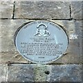
William Bald commemoration plaque
Installed by Burntisland Heritage Trust in 2008 https://www.burntisland.net/bald-plaque.htm
Image: © Michael Booth Taken: 17 Apr 2021
0.05 miles
8
Burntisland viaduct
Burntisland Viaduct was constructed in 1888 and carries the main line from Edinburgh to Dundee. It comprises nine spans of half-through construction with wrought iron lattice main girders on each elevation supporting trough decking and ballasted track. The span geometry varies throughout. Six spans are simply supported on masonry piers, but the easternmost three are continuous over intermediate cast iron columns. The viaduct is a category C listed structure and forms a significant feature within the harbour area.
Image: © Paul McIlroy Taken: 3 May 2007
0.05 miles
9
Burntisland viaduct
Close up of viaduct structure Image
Image: © Paul McIlroy Taken: 3 May 2007
0.06 miles
10
Seaforth Place, Burntisland
Image: © Stanley Howe Taken: 4 Apr 2009
0.07 miles
  • ...