IMAGES TAKEN NEAR TO
Bruce Street, ST. ANDREWS, KY16 8EB
Introduction
This page details the photographs taken nearby to Bruce Street, KY16 8EB by members of the Geograph project.
The Geograph project started in 2005 with the aim of publishing, organising and preserving representative images for every square kilometre of Great Britain, Ireland and the Isle of Man.

There are currently over 7.5m images from over14,400 individuals and you can help contribute to the project by visiting https://www.geograph.org.uk
Image Map
Images are licensed for reuse under creativecommons.org/licenses/by-sa/2.0
Notes
- Clicking on the map will re-center to the selected point.
- The higher the marker number, the further away the image location is from the centre of the postcode.
Image Listing (15 Images Found)
Images are licensed for reuse under creativecommons.org/licenses/by-sa/2.0
Image
Details
Distance
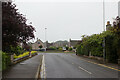
1
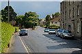
Pipleland Road, St Andrews
By its north end junction with Kinnessburn Road.
Image: © Jim Bain
Taken: 14 Jun 2008
0.12 miles
3
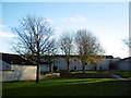
Between Tom Morris Drive and Hamilton Avenue
Residential area, St Andrews.
Image: © Richard Webb
Taken: 26 Nov 2015
0.16 miles
4
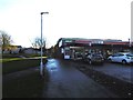
Shop off Tom Morris Drive
A path runs through this residential area to Pipeland.
Image: © Richard Webb
Taken: 26 Nov 2015
0.18 miles
5
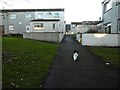
Towards James Rob Avenue
Cat wants to find out more about my camera.
Image: © Richard Webb
Taken: 26 Nov 2015
0.20 miles
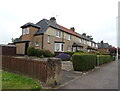
6
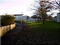
Wishart Gardens
Residential area of St Andrews.
Image: © Richard Webb
Taken: 26 Nov 2015
0.20 miles
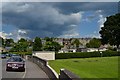
8
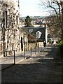
Ladebraes, St Andrews
From Queens Terrace looking north and down the steep brae to the Kinness burn and Kinnessburn Road
Image: © Jim Bain
Taken: 1 Apr 2006
0.22 miles
9
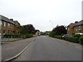
Lamond Drive approaching the junction with Largo Road
Image: © Mark Anderson
Taken: 22 Aug 2021
0.23 miles
10
Pipeland Road
The north end of Pipeland Road by the bowling club.
Image: © Jim Bain
Taken: 19 Jun 2012
0.23 miles