IMAGES TAKEN NEAR TO
Church Lane, CHESSINGTON, KT9 2DP
Introduction
This page details the photographs taken nearby to Church Lane, KT9 2DP by members of the Geograph project.
The Geograph project started in 2005 with the aim of publishing, organising and preserving representative images for every square kilometre of Great Britain, Ireland and the Isle of Man.

There are currently over 7.5m images from over14,400 individuals and you can help contribute to the project by visiting https://www.geograph.org.uk
Image Map
Images are licensed for reuse under creativecommons.org/licenses/by-sa/2.0
Notes
- Clicking on the map will re-center to the selected point.
- The higher the marker number, the further away the image location is from the centre of the postcode.
Image Listing (60 Images Found)
Images are licensed for reuse under creativecommons.org/licenses/by-sa/2.0
Image
Details
Distance

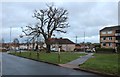
4
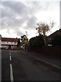
Church Rise looking towards Compton Crescent
Image: © David Howard
Taken: 5 Nov 2012
0.10 miles
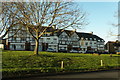
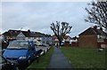
5
Church Rise, Chessington
These sort of houses circle most of London from around 6 miles to the edge.
Image: © David Howard
Taken: 5 Nov 2012
0.11 miles
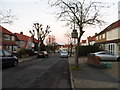
6
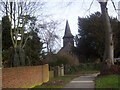
St Mary's Church, Chessington
Ancient church in an area of mostly 20th century development
Image: © peter clayton
Taken: 31 Jan 2010
0.11 miles