IMAGES TAKEN NEAR TO
Mount Road, CHESSINGTON, KT9 1JL
Introduction
This page details the photographs taken nearby to Mount Road, KT9 1JL by members of the Geograph project.
The Geograph project started in 2005 with the aim of publishing, organising and preserving representative images for every square kilometre of Great Britain, Ireland and the Isle of Man.

There are currently over 7.5m images from over14,400 individuals and you can help contribute to the project by visiting https://www.geograph.org.uk
Image Map
Images are licensed for reuse under creativecommons.org/licenses/by-sa/2.0
Notes
- Clicking on the map will re-center to the selected point.
- The higher the marker number, the further away the image location is from the centre of the postcode.
Image Listing (12 Images Found)
Images are licensed for reuse under creativecommons.org/licenses/by-sa/2.0
Image
Details
Distance
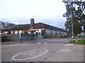
5
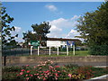
Heavy Reading
Library for Bricks ? One wonders what the ISBN number is for a common house brick.
Image: © Dennis Turner
Taken: 21 Aug 2005
0.19 miles
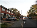
6
End of Chessington Hill Park
Photo taken from Public Footpath.
Image: © James Emmans
Taken: 18 Aug 2016
0.19 miles
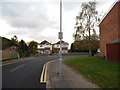
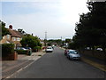
7
Bend in Dead End Road - Pear Tree Close
Housing built in the 1990s.
Image: © James Emmans
Taken: 18 Aug 2016
0.19 miles
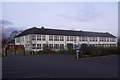
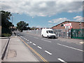
8
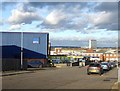
Trading estate, Roebuck Road
The view is roughly NNE, with Tolworth Tower in the middle distance.
Image: © Stefan Czapski
Taken: 5 Jan 2018
0.21 miles
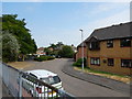
9
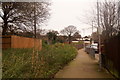
Footpath from Moor Lane to Pear Tree Close, Chessington
Image: © Mike Pennington
Taken: 1 Jan 2016
0.22 miles