IMAGES TAKEN NEAR TO
Red Lion Road, SURBITON, KT6 7RA
Introduction
This page details the photographs taken nearby to Red Lion Road, KT6 7RA by members of the Geograph project.
The Geograph project started in 2005 with the aim of publishing, organising and preserving representative images for every square kilometre of Great Britain, Ireland and the Isle of Man.

There are currently over 7.5m images from over14,400 individuals and you can help contribute to the project by visiting https://www.geograph.org.uk
Image Map
Images are licensed for reuse under creativecommons.org/licenses/by-sa/2.0
Notes
- Clicking on the map will re-center to the selected point.
- The higher the marker number, the further away the image location is from the centre of the postcode.
Image Listing (18 Images Found)
Images are licensed for reuse under creativecommons.org/licenses/by-sa/2.0
Image
Details
Distance
1
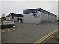
Chancerygate Business Centre
Off Red Lion Road.
Image: © Hugh Venables
Taken: 30 Dec 2015
0.02 miles
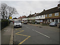
2
Advantage Day Nursery off Red Lion Road
Image: © Hugh Venables
Taken: 30 Dec 2015
0.05 miles
7
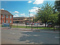
Tolworth Girls' School
The school is also a specialist technology college and centre for continuing education. The building in the centre of the picture is Tolworth Recreation Centre which shares the campus with the school.
Image: © Dennis Turner
Taken: 21 Aug 2005
0.17 miles
9
North of Hook Rise North
This might even be a part of Hook Rise North but I can't find a labelled map.
Image: © Shazz
Taken: 22 Jan 2015
0.19 miles