IMAGES TAKEN NEAR TO
Ewell Road, SURBITON, KT6 7AX
Introduction
This page details the photographs taken nearby to Ewell Road, KT6 7AX by members of the Geograph project.
The Geograph project started in 2005 with the aim of publishing, organising and preserving representative images for every square kilometre of Great Britain, Ireland and the Isle of Man.

There are currently over 7.5m images from over14,400 individuals and you can help contribute to the project by visiting https://www.geograph.org.uk
Image Map
Images are licensed for reuse under creativecommons.org/licenses/by-sa/2.0
Notes
- Clicking on the map will re-center to the selected point.
- The higher the marker number, the further away the image location is from the centre of the postcode.
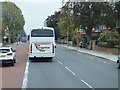
Image Listing (88 Images Found)
Images are licensed for reuse under creativecommons.org/licenses/by-sa/2.0
Image
Details
Distance
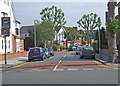
4
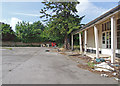
Awaiting re-development
Part of the disused car park of the former Red Lion public house.
Image: © Dennis Turner
Taken: 27 Jun 2009
0.02 miles
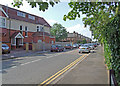
9
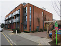
New shops and flats
See Image for the last days of the pub that used to be here.
Image: © Hugh Venables
Taken: 30 Dec 2015
0.05 miles
10
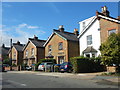
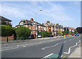
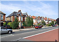
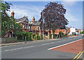
Victorian Semi-detached Houses in Red Lion Road
Image: © James Emmans
Taken: 20 Aug 2016
0.06 miles