IMAGES TAKEN NEAR TO
Ravens Close, SURBITON, KT6 4QG

Introduction

This page details the photographs taken nearby to Ravens Close, KT6 4QG by members of the Geograph project.

The Geograph project started in 2005 with the aim of publishing, organising and preserving representative images for every square kilometre of Great Britain, Ireland and the Isle of Man.

There are currently over 7.5m images from over14,400 individuals and you can help contribute to the project by visiting https://www.geograph.org.uk

Image Map


Images are licensed for reuse under creativecommons.org/licenses/by-sa/2.0
Notes
  • Clicking on the map will re-center to the selected point.
  • The higher the marker number, the further away the image location is from the centre of the postcode.

Image Listing (160 Images Found)

Images are licensed for reuse under creativecommons.org/licenses/by-sa/2.0
  • ...
Image
Details
Distance
1
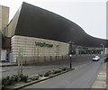
Surbiton Waitrose
From the car park, which also has a lower layer.
Image: © Hugh Venables Taken: 12 Mar 2016
0.04 miles
2
Waitrose, Surbiton
One of two supermarkets in Surbiton, there also being a Sainsbury's.
Image: © Hugh Venables Taken: 12 Mar 2016
0.07 miles
3
Reflection of Surbiton's Coronation Clock Tower
Surbiton's Coronation Clock Tower was completed in 1908 to commemorate the coronation of King Edward VIIth in 1902. The tower stands 20 metres high and is located in the Claremont Conservation Area at the southern end of Claremont Gardens. It is Grade I Listed. This is not the clock tower itself but its reflection in a building across the road. For more information see http://www.victorianweb.org/art/architecture/johnsonj/4.html
Image: © Marathon Taken: 5 Jun 2013
0.08 miles
4
Reflection of Surbiton's Coronation Clock Tower
Surbiton's Coronation Clock Tower was completed in 1908 to commemorate the coronation of King Edward VIIth in 1902. The tower stands 20 metres high and is located in the Claremont Conservation Area at the southern end of Claremont Gardens. It is Grade I Listed. This is not the clock tower itself but its reflection in a building across the road. The original can be seen at www.geograph.org.uk/photo/7808062 For more information see http://www.victorianweb.org/art/architecture/johnsonj/4.html
Image: © Marathon Taken: 26 Jun 2024
0.08 miles
5
Maple Road, Surbiton
Image: © David Howard Taken: 14 Jul 2008
0.08 miles
6
Clock Tower, Claremont Road
The Clock Tower was built to commemorate the coronation of King Edward 7th in 1902. It was completed in 1908, which was considerably nearer the end of his reign than the beginning. He passed away in 1910. http://research.kingston.ac.uk/clocktower/history.html
Image: © Des Blenkinsopp Taken: 14 Jul 2016
0.09 miles
7
Claremont Road, Surbiton
Claremont is a country house and park in nearby Esher, which may be where this street name comes from.
Image: © Des Blenkinsopp Taken: 14 Jul 2016
0.09 miles
8
Surbiton's Coronation Clock Tower
Surbiton's Coronation Clock Tower was completed in 1908 to commemorate the coronation of King Edward VIIth in 1902. The tower stands 20 metres high and is located in the Claremont Conservation Area at the southern end of Claremont Gardens. It is Grade I Listed. There is a good reflection of the clock tower in a building opposite - see www.geograph.org.uk/photo/7808066 For more information see http://www.victorianweb.org/art/architecture/johnsonj/4.html
Image: © Marathon Taken: 26 Jun 2024
0.09 miles
9
Coronation Clock Tower, Surbiton
To commemorate the coronation of Edward VII.
Image: © Bill Boaden Taken: 12 Sep 2013
0.09 miles
10
Waitrose on Claremont Road, Surbiton
Image: © David Howard Taken: 6 Nov 2016
0.09 miles
  • ...