IMAGES TAKEN NEAR TO
Antelope Walk, SURBITON, KT6 4AQ
Introduction
This page details the photographs taken nearby to Antelope Walk, KT6 4AQ by members of the Geograph project.
The Geograph project started in 2005 with the aim of publishing, organising and preserving representative images for every square kilometre of Great Britain, Ireland and the Isle of Man.

There are currently over 7.5m images from over14,400 individuals and you can help contribute to the project by visiting https://www.geograph.org.uk
Image Map
Images are licensed for reuse under creativecommons.org/licenses/by-sa/2.0
Notes
- Clicking on the map will re-center to the selected point.
- The higher the marker number, the further away the image location is from the centre of the postcode.
Image Listing (138 Images Found)
Images are licensed for reuse under creativecommons.org/licenses/by-sa/2.0
Image
Details
Distance
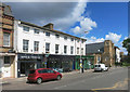
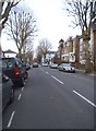
2
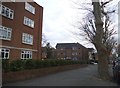
Maple Road, Surbiton
A real mixture of shops, houses, offices, pubs etc.
Image: © Des Blenkinsopp
Taken: 14 Jul 2016
0.05 miles
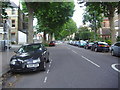
3
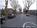
Maple Road, Surbiton
A relatively rare straight road in Britain. They are definitely the exception and not the rule.
Image: © David Howard
Taken: 23 Mar 2015
0.09 miles
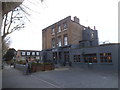
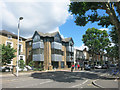
4
The Grove
A very square looking pub on the corner of Grove Road.
It looks like it was once part of a larger development.
Image: © Des Blenkinsopp
Taken: 14 Jul 2016
0.10 miles
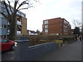
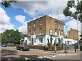
6
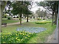
Claremont Gardens
A small open area close to Surbiton, probably looking its best at this time of year.
Image: © Hugh Venables
Taken: 9 Apr 2006
0.11 miles