IMAGES TAKEN NEAR TO
Stanton Close, WORCESTER PARK, KT4 8QD
Introduction
This page details the photographs taken nearby to Stanton Close, KT4 8QD by members of the Geograph project.
The Geograph project started in 2005 with the aim of publishing, organising and preserving representative images for every square kilometre of Great Britain, Ireland and the Isle of Man.

There are currently over 7.5m images from over14,400 individuals and you can help contribute to the project by visiting https://www.geograph.org.uk
Image Map
Images are licensed for reuse under creativecommons.org/licenses/by-sa/2.0
Notes
- Clicking on the map will re-center to the selected point.
- The higher the marker number, the further away the image location is from the centre of the postcode.
Image Listing (9 Images Found)
Images are licensed for reuse under creativecommons.org/licenses/by-sa/2.0
Image
Details
Distance
1
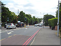
North Cheam: Clarke's Avenue
From its junction with London Road
Image: © Dr Neil Clifton
Taken: 26 Jul 2013
0.15 miles
2
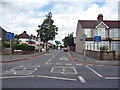
North Cheam: Garth Road
Traffic-calming measures* are in use on this popular through route.
*They do not calm drivers, they usually infuriate them.
Image: © Dr Neil Clifton
Taken: 26 Jul 2013
0.17 miles
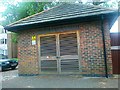
3
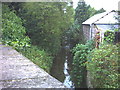
Pyl Brook, Morden.
From the Garth Road bridge, south side.
Image: © Noel Foster
Taken: 26 Jul 2005
0.18 miles
4
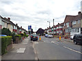
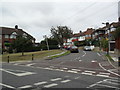
North Cheam: Stonecot Hill
The junction with Gander Green Lane is on the right. Opposite to this is the entrance to St. Anthony's Hospital.
Image: © Dr Neil Clifton
Taken: 26 Jul 2013
0.20 miles
5
Garth Road
1930s houses at the junction of Dunster Avenue in Lower Morden.
Image: © Burgess Von Thunen
Taken: 13 Oct 2011
0.22 miles
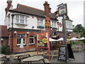
6

North Cheam: The 'Lord Nelson'
Appropriately, at the end of Trafalgar Avenue.
Image: © Dr Neil Clifton
Taken: 26 Jul 2013
0.23 miles
9
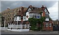
The Lord Nelson public house, Sutton
On London Road.
Image: © JThomas
Taken: 25 Jul 2022
0.24 miles