IMAGES TAKEN NEAR TO
South Lane, NEW MALDEN, KT3 5HQ
Introduction
This page details the photographs taken nearby to South Lane, KT3 5HQ by members of the Geograph project.
The Geograph project started in 2005 with the aim of publishing, organising and preserving representative images for every square kilometre of Great Britain, Ireland and the Isle of Man.

There are currently over 7.5m images from over14,400 individuals and you can help contribute to the project by visiting https://www.geograph.org.uk
Image Map
Images are licensed for reuse under creativecommons.org/licenses/by-sa/2.0
Notes
- Clicking on the map will re-center to the selected point.
- The higher the marker number, the further away the image location is from the centre of the postcode.
Image Listing (5 Images Found)
Images are licensed for reuse under creativecommons.org/licenses/by-sa/2.0
Image
Details
Distance
3
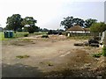
Recreation Ground, Hogsmill Valley
Pavilion and rugby pitch on the New Malden bank of the Hogsmill River Park.
Image: © Colin Smith
Taken: 15 Dec 2011
0.21 miles
4
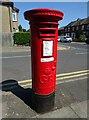
George V postbox on Franks Avenue, New Malden
Postbox No. KT3 204.
Image: © JThomas
Taken: 29 Jul 2022
0.25 miles