IMAGES TAKEN NEAR TO
Coombe Ridings, KINGSTON UPON THAMES, KT2 7JT
Introduction
This page details the photographs taken nearby to Coombe Ridings, KT2 7JT by members of the Geograph project.
The Geograph project started in 2005 with the aim of publishing, organising and preserving representative images for every square kilometre of Great Britain, Ireland and the Isle of Man.

There are currently over 7.5m images from over14,400 individuals and you can help contribute to the project by visiting https://www.geograph.org.uk
Image Map
Images are licensed for reuse under creativecommons.org/licenses/by-sa/2.0
Notes
- Clicking on the map will re-center to the selected point.
- The higher the marker number, the further away the image location is from the centre of the postcode.
Image Listing (61 Images Found)
Images are licensed for reuse under creativecommons.org/licenses/by-sa/2.0
Image
Details
Distance
1
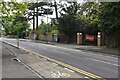
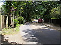
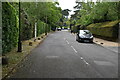
Coombe Wood Road
Coombe Wood Road off Kingston Hill
Image: © Shaun Ferguson
Taken: 25 Jun 2008
0.11 miles
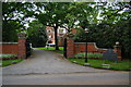
2
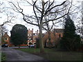
Warren House, Coombe
Small country house, now a Grade II listed conference centre.
It was built in 1860's for Hugh Hamersley, extended 1884-6 by the architect George Devey for George Grenfell Glyn, Lord Wolverton.
See http://en.wikipedia.org/wiki/George_Glyn,_2nd_Baron_Wolverton for more details about the Lord.
See http://www.britishlistedbuildings.co.uk/en-479388-warren-house-greater-london-authority for more details about the country house.
Image: © David Anstiss
Taken: 13 Jan 2013
0.14 miles
3
Warren House
Built in 1860 for banker Hugh Hammersley, and greatly extended later by another owner, it was for a while owned by ICI as a conference and training centre. Under later ownership it continues in these roles and also caters for weddings and similar functions.
Image: © Robin Webster
Taken: 22 Apr 2012
0.14 miles
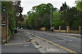
4
Warren Road
Warren Road off Kingston Hill
Image: © Shaun Ferguson
Taken: 25 Jun 2008
0.14 miles
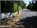
5
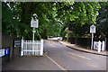
The beginning of the Coombe Estate
This is at the Kingston Hill end. The sign to the left states that General Eisenhower lived along this road for a while.
Image: © Bill Boaden
Taken: 7 May 2011
0.14 miles
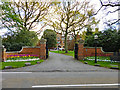
6
Warren House
A conference centre on Warren Road.
Image: © Bill Boaden
Taken: 7 May 2011
0.15 miles
9
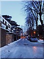
Ladderstile Ride in snow
Looking SE from near Ladderstile Gate towards Kingston Hill, some 36 hours after the first substantial snowfall of the winter. Ladderstile Gate, once known as Coombe Gate, is one of Richmond Park's pedestrian gates. The name derives from a step-ladder which gave access over the Park wall until replaced by a conventional gate in or about 1885. (Historical information from Collenette's book, 'A History of Richmond Park').
Image: © Stefan Czapski
Taken: 3 Dec 2010
0.15 miles