IMAGES TAKEN NEAR TO
Coombe Lane West, KINGSTON UPON THAMES, KT2 7BX
Introduction
This page details the photographs taken nearby to Coombe Lane West, KT2 7BX by members of the Geograph project.
The Geograph project started in 2005 with the aim of publishing, organising and preserving representative images for every square kilometre of Great Britain, Ireland and the Isle of Man.

There are currently over 7.5m images from over14,400 individuals and you can help contribute to the project by visiting https://www.geograph.org.uk
Image Map
Images are licensed for reuse under creativecommons.org/licenses/by-sa/2.0
Notes
- Clicking on the map will re-center to the selected point.
- The higher the marker number, the further away the image location is from the centre of the postcode.
Image Listing (34 Images Found)
Images are licensed for reuse under creativecommons.org/licenses/by-sa/2.0
Image
Details
Distance
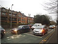
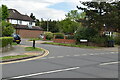
1
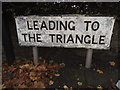
Sign to The Triangle on Dickerage Road
If you compare with the national system of fonts this was made before 1957
Image: © David Howard
Taken: 18 Nov 2013
0.10 miles
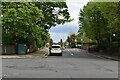
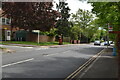
9
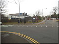
Coombe Road at the junction of Galsworthy Road
Kingston Hospital is on the left
Image: © David Howard
Taken: 19 Dec 2016
0.15 miles