IMAGES TAKEN NEAR TO
The Keep, KINGSTON UPON THAMES, KT2 5UE

Introduction

This page details the photographs taken nearby to The Keep, KT2 5UE by members of the Geograph project.

The Geograph project started in 2005 with the aim of publishing, organising and preserving representative images for every square kilometre of Great Britain, Ireland and the Isle of Man.

There are currently over 7.5m images from over14,400 individuals and you can help contribute to the project by visiting https://www.geograph.org.uk

Image Map


Images are licensed for reuse under creativecommons.org/licenses/by-sa/2.0
Notes
  • Clicking on the map will re-center to the selected point.
  • The higher the marker number, the further away the image location is from the centre of the postcode.

Image Listing (26 Images Found)

Images are licensed for reuse under creativecommons.org/licenses/by-sa/2.0
  • ...
Image
Details
Distance
1
Pavilion
Image: © N Chadwick Taken: 17 May 2021
0.07 miles
2
Mosaic mural, Castle Street, Kingston upon Thames
Image: © Jim Osley Taken: 14 May 2010
0.11 miles
3
Latchmere Recreation Ground
This view of Latchmere Recreation Ground is taken close to the entrance at the junction of Latchmere Road and Latchmere Lane and looking parallel to the former. The children's playground can just be glimpsed in the distance.
Image: © Marathon Taken: 10 Aug 2011
0.11 miles
4
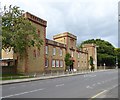
The Old East Surrey Barracks
This building in King's Road is the entrance to the old East Surrey Barracks. Most of the land is now a housing estate
Image: © steve Taken: 14 May 2005
0.15 miles
5
Former East Surrey Barracks, King's Road
Much of the site is now occupied by residential development - known as The Keep.
Image: © Stefan Czapski Taken: 6 Sep 2017
0.15 miles
6
The Barracks, Kingston
In use from 1875 - 1959. The keep was retained, whilst most of the site was developed for housing, following demolition in 1962. In 2011 a developer submitted proposals to convert the keep into flats.
Image: © Peter Trimming Taken: 21 Nov 2017
0.15 miles
7
Latchmere Recreation Ground
This view of Latchmere Recreation Ground is taken close to the entrance at the junction of Latchmere Road and Latchmere Lane and looking parallel to the latter. The children's playground can just be glimpsed in the distance.
Image: © Marathon Taken: 10 Aug 2011
0.17 miles
8
Bockhampton Rd
Image: © N Chadwick Taken: 17 May 2021
0.18 miles
9
Park Rd
Image: © N Chadwick Taken: 17 May 2021
0.18 miles
10
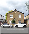
Victorian semis, King's Road Kingston
Image: © Stefan Czapski Taken: 6 Sep 2017
0.18 miles
  • ...