IMAGES TAKEN NEAR TO
Ockham Road North, LEATHERHEAD, KT24 6PF
Introduction
This page details the photographs taken nearby to Ockham Road North, KT24 6PF by members of the Geograph project.
The Geograph project started in 2005 with the aim of publishing, organising and preserving representative images for every square kilometre of Great Britain, Ireland and the Isle of Man.

There are currently over 7.5m images from over14,400 individuals and you can help contribute to the project by visiting https://www.geograph.org.uk
Image Map
Images are licensed for reuse under creativecommons.org/licenses/by-sa/2.0
Notes
- Clicking on the map will re-center to the selected point.
- The higher the marker number, the further away the image location is from the centre of the postcode.
Image Listing (19 Images Found)
Images are licensed for reuse under creativecommons.org/licenses/by-sa/2.0
Image
Details
Distance
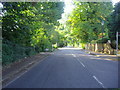
2
Ockham Road North at the junction of East Lane
Image: © David Howard
Taken: 5 Oct 2014
0.08 miles
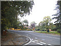
3
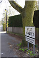
Entering West Horsley
This oddly positioned village sign appears to acknowledge the parish boundary between East and West Horsley which runs along Ockham Road North.
Image: © Stephen McKay
Taken: 24 Mar 2014
0.09 miles
4
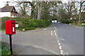
East Lane, West Horsley
A post box stands at the junction of East Lane and Nightingale Avenue in this well-heeled commuter village.
Image: © Stephen McKay
Taken: 24 Mar 2014
0.11 miles
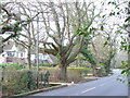
6
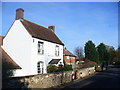
Waterloo Farm Cottage
Old cottage on East Lane in the village of East Horsley.
http://www.british-history.ac.uk/report.aspx?compid=42982
Image: © Colin Smith
Taken: 10 Dec 2011
0.15 miles
7
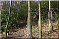
Blue Ride, East Horsley
This path runs parallel to Ockham Road North for a short distance before turning deeper into the wood. The names seem confusing here; the OS marks the woodland as 'Blue Ride' or 'Blue Ridge' at different scales, elsewhere the Blue Ride name is used to refer to the path itself.
Image: © Stephen McKay
Taken: 24 Mar 2014
0.16 miles
9
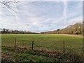
Meadow Way
West Horsley housing in commuting distance of London. Horsley Station is about 10 minutes walk away.
Image: © Colin Smith
Taken: 11 Jan 2009
0.19 miles
10
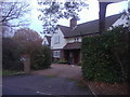
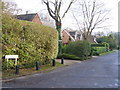
Ockham Road North
Upmarket housing with names, not numbers, and located near to Horsley Station for commuting to Waterloo.
Image: © Colin Smith
Taken: 11 Jan 2009
0.19 miles