IMAGES TAKEN NEAR TO
Aston Close, ASHTEAD, KT21 2LQ
Introduction
This page details the photographs taken nearby to Aston Close, KT21 2LQ by members of the Geograph project.
The Geograph project started in 2005 with the aim of publishing, organising and preserving representative images for every square kilometre of Great Britain, Ireland and the Isle of Man.

There are currently over 7.5m images from over14,400 individuals and you can help contribute to the project by visiting https://www.geograph.org.uk
Image Map
Images are licensed for reuse under creativecommons.org/licenses/by-sa/2.0
Notes
- Clicking on the map will re-center to the selected point.
- The higher the marker number, the further away the image location is from the centre of the postcode.
Image Listing (11 Images Found)
Images are licensed for reuse under creativecommons.org/licenses/by-sa/2.0
Image
Details
Distance
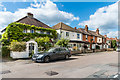
1
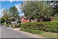
Harriott's Lane
Former country lane which saw some development early in the 20th Century but mainly between the wars.
Image: © Ian Capper
Taken: 7 Sep 2018
0.07 miles
3
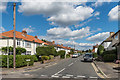
Oakhill Road
c1930s semis on Oakhill Road.
Image: © Ian Capper
Taken: 7 Sep 2018
0.13 miles
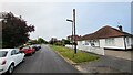
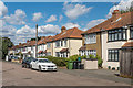
4
Caen Wood Road
Edwardian houses on Caen Wood Road. The far terrace has a plaque stating "Olive Cottages 1904".
Image: © Ian Capper
Taken: 7 Sep 2018
0.14 miles
5
Harriott's Lane
Former country lane which saw some development early in the 20th Century but mainly between the wars.
Image: © Ian Capper
Taken: 7 Sep 2018
0.16 miles
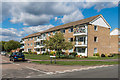
6
Caen Wood Road
c1930s semis on Caen Wood Road.
Image: © Ian Capper
Taken: 7 Sep 2018
0.17 miles
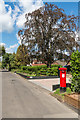
7
Floral Court
Group of 1960s apartment blocks at the junction of Rosedale and Oakhill Road. Both Floral Court and Roasedale commemorate the rose garden and nursery operated by nurseryman Henry Weller from the early 1900s until around the 1950s after which it was developed for housing.
Image: © Ian Capper
Taken: 7 Sep 2018
0.21 miles
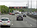
8
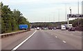
M25 Services in 3 miles
Image: © Julian P Guffogg
Taken: 7 Aug 2013
0.23 miles
9
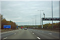
M25 - services 47 miles
It is regrettable that the Highways Agency uses the internationally recognized abbreviation for a metre to represent a mile.
Image: © Robin Webster
Taken: 9 Nov 2011
0.23 miles