IMAGES TAKEN NEAR TO
Ebbisham Lane, TADWORTH, KT20 7UP
Introduction
This page details the photographs taken nearby to Ebbisham Lane, KT20 7UP by members of the Geograph project.
The Geograph project started in 2005 with the aim of publishing, organising and preserving representative images for every square kilometre of Great Britain, Ireland and the Isle of Man.

There are currently over 7.5m images from over14,400 individuals and you can help contribute to the project by visiting https://www.geograph.org.uk
Image Map
Images are licensed for reuse under creativecommons.org/licenses/by-sa/2.0
Notes
- Clicking on the map will re-center to the selected point.
- The higher the marker number, the further away the image location is from the centre of the postcode.
Image Listing (88 Images Found)
Images are licensed for reuse under creativecommons.org/licenses/by-sa/2.0
Image
Details
Distance
1
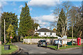
Ebbisham Lane
Ebbisham Lane where it meets Chequers Lane and Walton Street.
Image: © Ian Capper
Taken: 10 Jan 2020
0.11 miles
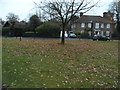
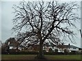
2
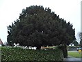
Tree on Chequers Lane, Walton on the Hill
Image: © David Howard
Taken: 20 Nov 2016
0.12 miles
3
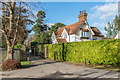
Walton Manor Lodge
Lodge to Walton Manor, built in 1891.
Image: © Ian Capper
Taken: 10 Jan 2020
0.12 miles
4
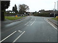
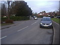
Walton on the Hill
The central route past the green
Image: © David Howard
Taken: 20 Nov 2016
0.13 miles
5
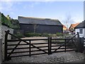
Walton on the Hill: barn at Pond Farm Close
Seen from the main village street. The former farmyard at Pond Farm is now the site of modern residential development.
Image: © Stefan Czapski
Taken: 5 Jan 2018
0.13 miles
6
Chequers Lane, Walton-on-the Hill
The centre of the village
Image: © David Howard
Taken: 20 Feb 2012
0.14 miles
7
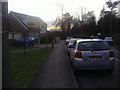
Chequers Lane, Walton-on-the Hill
The centre of the village
Image: © David Howard
Taken: 20 Feb 2012
0.14 miles
10
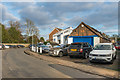
Chequers Lane Garage
Garage on Chequers Lane, in a premises first shown on the 1935 1:2,500 map. In the left background is the wall to Walton Manor.
Image: © Ian Capper
Taken: 10 Jan 2020
0.15 miles