IMAGES TAKEN NEAR TO
Barons Hurst, EPSOM, KT18 7DU
Introduction
This page details the photographs taken nearby to Barons Hurst, KT18 7DU by members of the Geograph project.
The Geograph project started in 2005 with the aim of publishing, organising and preserving representative images for every square kilometre of Great Britain, Ireland and the Isle of Man.

There are currently over 7.5m images from over14,400 individuals and you can help contribute to the project by visiting https://www.geograph.org.uk
Image Map
Images are licensed for reuse under creativecommons.org/licenses/by-sa/2.0
Notes
- Clicking on the map will re-center to the selected point.
- The higher the marker number, the further away the image location is from the centre of the postcode.
Image Listing (8 Images Found)
Images are licensed for reuse under creativecommons.org/licenses/by-sa/2.0
Image
Details
Distance
3
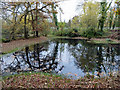
Pond, Epsom Common
Called by a local resident the "Baron's Pond", this name has never appeared on maps, which label it a fish pond. Modern maps show one pond of simple shape, but Victorian maps more accurately depict the current state, which is of quite complex shape. Shown is the southern part. Over the bank on the left is the northern part, currently partly a sallow swamp. The two are interconnected around the end of the bank, more obviously when the water level is higher. The local resident remarked that the level used to be higher.
Image: © Robin Webster
Taken: 23 Nov 2010
0.16 miles
4
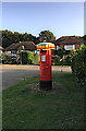
Post box with sun hat on Oak Hill
Post box at the top of Oak Hill, part of the Woodcote Estate.
Image: © Hugh Craddock
Taken: 17 Sep 2020
0.18 miles
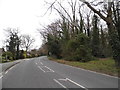
6
Loop Road at the junction of Wilmerhatch Lane
Image: © David Howard
Taken: 30 Mar 2014
0.19 miles
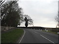
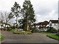
8
Pine Hill
From the top of Pine Hill, at the junction with Warren Hill, on the private Woodcote Estate.
Image: © Hugh Craddock
Taken: 12 Oct 2008
0.25 miles