IMAGES TAKEN NEAR TO
Longdown Road, EPSOM, KT17 3PT
Introduction
This page details the photographs taken nearby to Longdown Road, KT17 3PT by members of the Geograph project.
The Geograph project started in 2005 with the aim of publishing, organising and preserving representative images for every square kilometre of Great Britain, Ireland and the Isle of Man.

There are currently over 7.5m images from over14,400 individuals and you can help contribute to the project by visiting https://www.geograph.org.uk
Image Map
Images are licensed for reuse under creativecommons.org/licenses/by-sa/2.0
Notes
- Clicking on the map will re-center to the selected point.
- The higher the marker number, the further away the image location is from the centre of the postcode.
Image Listing (27 Images Found)
Images are licensed for reuse under creativecommons.org/licenses/by-sa/2.0
Image
Details
Distance
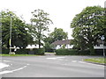
1
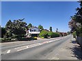
Alexander Road
The A2022 main road to Epsom town centre.
Image: © James Emmans
Taken: 6 May 2020
0.08 miles
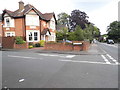
2
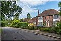
91 College Road
Early 20th Century house on College Road.
Image: © Ian Capper
Taken: 8 Jun 2018
0.10 miles
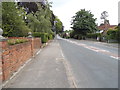
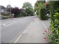
5
Alexandra Road at the junction of College Road, Epsom
Image: © David Howard
Taken: 1 Jun 2014
0.12 miles
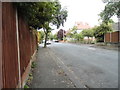
6
Ashdown Road at the junction of Alexandra Road
Image: © David Howard
Taken: 1 Jun 2014
0.12 miles
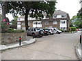
7

Kilcorral Close
c1970s cul-de-sac built on the site of nos 93 and 95 College Road.
Image: © Ian Capper
Taken: 8 Jun 2018
0.13 miles
10
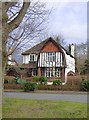
House in Higher Green (off Longdown Lane North)
A house that is pretty typical of many thousands built 'between the wars' as the Surrey suburbs grew outwards beyond older centres such as Wimbledon, Kingston and Croydon.
The builder who developed The Green and Higher Green* was clearly concerned to produce a picturesque effect - using designs inspired by local rural tradition. A glance at http://www.geograph.org.uk/photo/5656676 shows that he had a variety of designs in his pattern book, and avoided using the same design on adjacent plots. Notice in particular the house on the right in that picture, which shares its gable design with the house in the picture above. Further variety was introduced by 'handing' - the gable on the larger house is on the left, but on the right in the smaller.
* Hugh Craddock gives his name as Ernest Harwood: http://www.geograph.org.uk/photo/1116038
Image: © Stefan Czapski
Taken: 18 Jan 2018
0.18 miles