House in Higher Green (off Longdown Lane North)
Introduction
The photograph on this page of House in Higher Green (off Longdown Lane North) by Stefan Czapski as part of the Geograph project.
The Geograph project started in 2005 with the aim of publishing, organising and preserving representative images for every square kilometre of Great Britain, Ireland and the Isle of Man.

There are currently over 7.5m images from over 14,400 individuals and you can help contribute to the project by visiting https://www.geograph.org.uk
House in Higher Green (off Longdown Lane North)
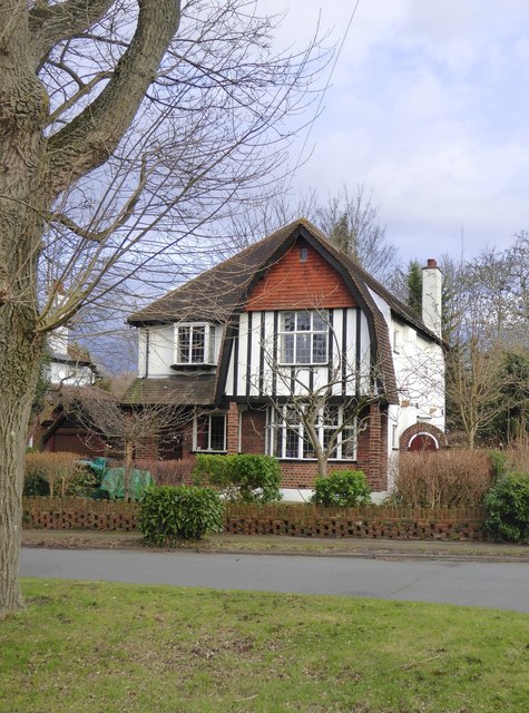
Image: © Stefan Czapski Taken: 18 Jan 2018
A house that is pretty typical of many thousands built 'between the wars' as the Surrey suburbs grew outwards beyond older centres such as Wimbledon, Kingston and Croydon. The builder who developed The Green and Higher Green* was clearly concerned to produce a picturesque effect - using designs inspired by local rural tradition. A glance at http://www.geograph.org.uk/photo/5656676 shows that he had a variety of designs in his pattern book, and avoided using the same design on adjacent plots. Notice in particular the house on the right in that picture, which shares its gable design with the house in the picture above. Further variety was introduced by 'handing' - the gable on the larger house is on the left, but on the right in the smaller. * Hugh Craddock gives his name as Ernest Harwood: http://www.geograph.org.uk/photo/1116038
Images are licensed for reuse under creativecommons.org/licenses/by-sa/2.0
Image Location
Latitude
51.332704
Longitude
-0.246017